Latitude: 51.5584 / 51°33'30"N
Longitude: -0.082 / 0°4'55"W
OS Eastings: 533054
OS Northings: 186134
OS Grid: TQ330861
Mapcode National: GBR HC.G0M
Mapcode Global: VHGQT.J3H5
Plus Code: 9C3XHW59+95
Entry Name: 174 to 178, Albion Road
Listing Date: 11 October 1974
Grade: II
Source: Historic England
Source ID: 1079861
English Heritage Legacy ID: 201709
ID on this website: 101079861
Location: Stoke Newington, Hackney, London, N16
County: London
District: Hackney
Electoral Ward/Division: Clissold
Parish: Non Civil Parish
Built-Up Area: Hackney
Traditional County: Middlesex
Lieutenancy Area (Ceremonial County): Greater London
Church of England Parish: St Mary Stoke Newington
Church of England Diocese: London
Tagged with: Building
This list entry was subject to a Minor Amendment on 26 January 2024 to reformat the text to current standards
TQ 3386
12/26
ALBION ROAD N16 (east side)
Nos 174 to 178 (even)
11.10.74.
GV
II
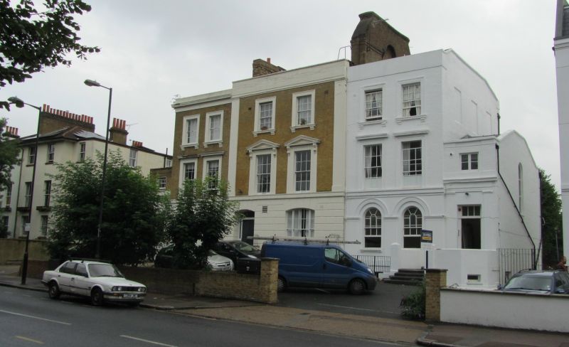
Mid C19 symmetrical composition, each house three storeys and basement, two windows. Central house projecting slightly with stuccoed angle pilasters. Yellow brick with stucco frieze, cornice and blocking course and a raised pediment-shaped central parapet. (No 174 lost cornice). Ground floor stuccoed, No 176 rusticated, forming voussoirs to segment-headed door and window. Others arcaded, having moulded architraves and impost band. Sash windows with glazing bars. Half-glazed four-panel doors with rectangular fanlights. Nos 174 and 178 have two storey outer entrance extensions.
Nos 166 to 184 (even) form a group.
Listing NGR: TQ3305486134
External links are from the relevant listing authority and, where applicable, Wikidata. Wikidata IDs may be related buildings as well as this specific building. If you want to add or update a link, you will need to do so by editing the Wikidata entry.


Other nearby listed buildings