Latitude: 51.5018 / 51°30'6"N
Longitude: -0.2092 / 0°12'33"W
OS Eastings: 524393
OS Northings: 179619
OS Grid: TQ243796
Mapcode National: GBR BG.5Y1
Mapcode Global: VHGQY.BJ71
Plus Code: 9C3XGQ2R+P8
Entry Name: 74, Addison Road W14
Listing Date: 8 August 1974
Grade: II
Source: Historic England
Source ID: 1080786
English Heritage Legacy ID: 203499
ID on this website: 101080786
Location: Kensington and Chelsea, London, W14
County: London
District: Kensington and Chelsea
Electoral Ward/Division: Holland
Built-Up Area: Kensington and Chelsea
Traditional County: Middlesex
Lieutenancy Area (Ceremonial County): Greater London
Church of England Parish: St Barnabas Addison Road
Church of England Diocese: London
Tagged with: Building
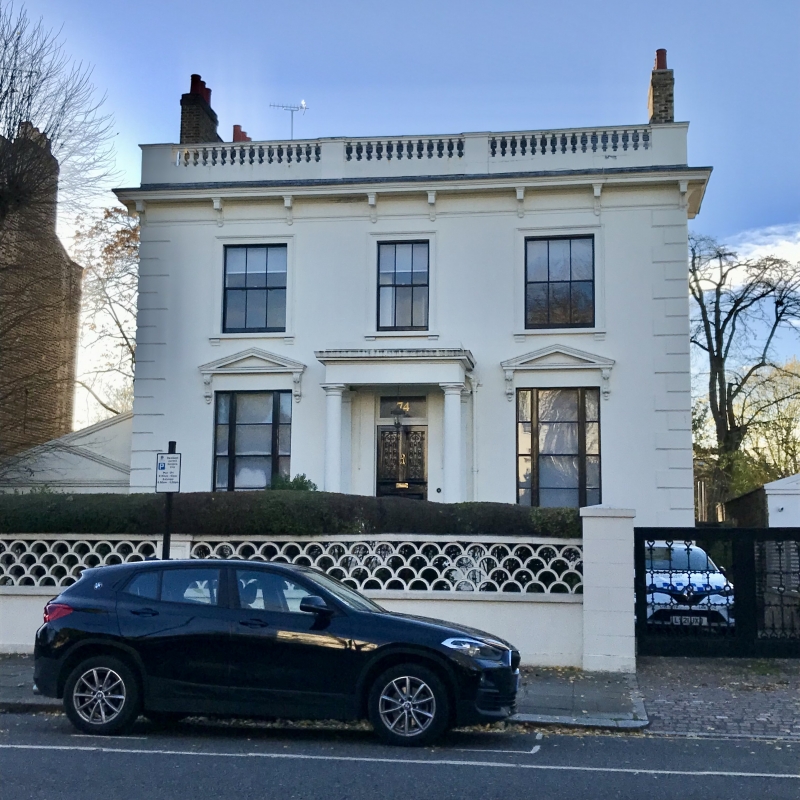
TQ 2479 NW ADDISON ROAD W14
28/16
8.8.74 No 74
GV
II
Circa 1860. Detached house. Two storeys plus basement. Three windows. Stucco
facade with rusticated quoins and cornice. Central porch on Tuscan columns.
Listing NGR: TQ2439379619
This text is from the original listing, and may not necessarily reflect the current setting of the building.
External links are from the relevant listing authority and, where applicable, Wikidata. Wikidata IDs may be related buildings as well as this specific building. If you want to add or update a link, you will need to do so by editing the Wikidata entry.


Other nearby listed buildings