Latitude: 52.2999 / 52°17'59"N
Longitude: -2.9331 / 2°55'59"W
OS Eastings: 336464
OS Northings: 267274
OS Grid: SO364672
Mapcode National: GBR B9.X6JN
Mapcode Global: VH76Y.3GQ7
Plus Code: 9C4V73X8+XP
Entry Name: The Forge and Building Attached to West
Listing Date: 19 February 1987
Grade: II
Source: Historic England
Source ID: 1082039
English Heritage Legacy ID: 149544
ID on this website: 101082039
Location: Lingen, County of Herefordshire, SY7
County: County of Herefordshire
Civil Parish: Lingen
Traditional County: Herefordshire
Lieutenancy Area (Ceremonial County): Herefordshire
Church of England Parish: Lingen
Church of England Diocese: Hereford
Tagged with: Smithy
SO 36 NE LINGEN CP -
9/78 The Forge and building attached to west
GV II
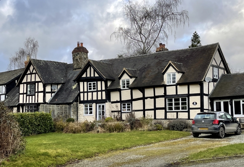
One house, now two. Probably C16 and C17 with later alterations. Sandstone rubble and timber-frame with plaster and brick infill. Tiled roof with large central and rear sandstone and brick stacks. Rectangular plan aligned west- north-west/east-south-east. One storey and attic. South elevation has 1:1:2 windows, to left two in exposed timber-framed gables. Left late C20 window has top vent and glazing bars. Late C19 two-light casement in second gable from left. Two early C20 gabled dormers with 2-light casements to right. Ground floor has late C20 glazing bar casements to left and right. Centre has two early C20 casements: Exposed sandstone between gables. Entry into right-hand return of left-hand gable is set diagonally and has four-panelled door: Second entry to right-hand side of the other gable. Left gable has jetty at first floor level beneath which are brackets and moulded oak cord and tassel motif attached to the corner posts. The right-hand gable has a moulded projecting tie-beam on brackets. Frame is close-studded with single rails to left and to gables. The right gable has much heavier scantling than the left. Right of the building has three square panels between cill and wall-plate. Interior inaccessible. The western part of the building was formerly known as Sunndyside (RCHM, Vol III, p 137).
Listing NGR: SO3646467274
External links are from the relevant listing authority and, where applicable, Wikidata. Wikidata IDs may be related buildings as well as this specific building. If you want to add or update a link, you will need to do so by editing the Wikidata entry.


Other nearby listed buildings