Latitude: 52.298 / 52°17'52"N
Longitude: -2.9315 / 2°55'53"W
OS Eastings: 336571
OS Northings: 267063
OS Grid: SO365670
Mapcode National: GBR B9.X6YD
Mapcode Global: VH76Y.4HLP
Plus Code: 9C4V73X9+69
Entry Name: The Old Farmhouse
Listing Date: 19 February 1987
Grade: II
Source: Historic England
Source ID: 1082040
English Heritage Legacy ID: 149546
ID on this website: 101082040
Location: Lingen, County of Herefordshire, SY7
County: County of Herefordshire
Civil Parish: Lingen
Traditional County: Herefordshire
Lieutenancy Area (Ceremonial County): Herefordshire
Church of England Parish: Lingen
Church of England Diocese: Hereford
Tagged with: Farmhouse
SO 36 NE LINGEN CP -
9/80 The Old Farmhouse
GV II
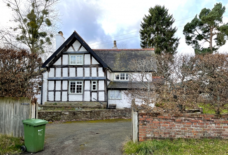
House. Probably early C17 with substantial early C20 alterations and additions. Timber-frame with plaster and brick infill. Brick and stucco additions. Welsh slate roof and brick stack. Roughly rectangular plan with early range aligned east/west and C20 northern addition aligned north/ south. One-and-a-half storeys and attic. East elevation has 1:3 windows, the timber-framed gable to left with a mid-C20 glazing bar 2-light casement to each floor. Right part has three windows and ground floor has a brick lean-to. Entry in early C20 timber porch to right-hand return. Second entry to left side of timber-framed part is masked by brick lean-to. Framing has three rectangular panels from cill to tie with V-struts above collar in gable front. Interior has beams with lamb's tongue run-out chamfer stops. Included for group value.
Listing NGR: SO3657167063
External links are from the relevant listing authority and, where applicable, Wikidata. Wikidata IDs may be related buildings as well as this specific building. If you want to add or update a link, you will need to do so by editing the Wikidata entry.


Other nearby listed buildings