Approximate Location Map
Large Map »
Latitude: 52.11 / 52°6'36"N
Longitude: -2.3341 / 2°20'2"W
OS Eastings: 377213
OS Northings: 245794
OS Grid: SO772457
Mapcode National: GBR 0FM.QPD
Mapcode Global: VH934.H7D9
Plus Code: 9C4V4M68+28
Entry Name: St Ann's Well
Listing Date: 1 January 1970
Grade: II
Source: Historic England
Source ID: 1082750
English Heritage Legacy ID: 152146
Also known as: St. Ann's Well, Malvern
ID on this website: 101082750
Location: Great Malvern, Malvern Hills, Worcestershire, WR14
County: Worcestershire
District: Malvern Hills
Civil Parish: Malvern
Built-Up Area: Great Malvern
Traditional County: Worcestershire
Lieutenancy Area (Ceremonial County): Worcestershire
Church of England Parish: Great Malvern
Church of England Diocese: Worcester
Tagged with: Human-made geographic feature Well house Cottage
ST ANN'S ROAD
1.
5245
(West Side)
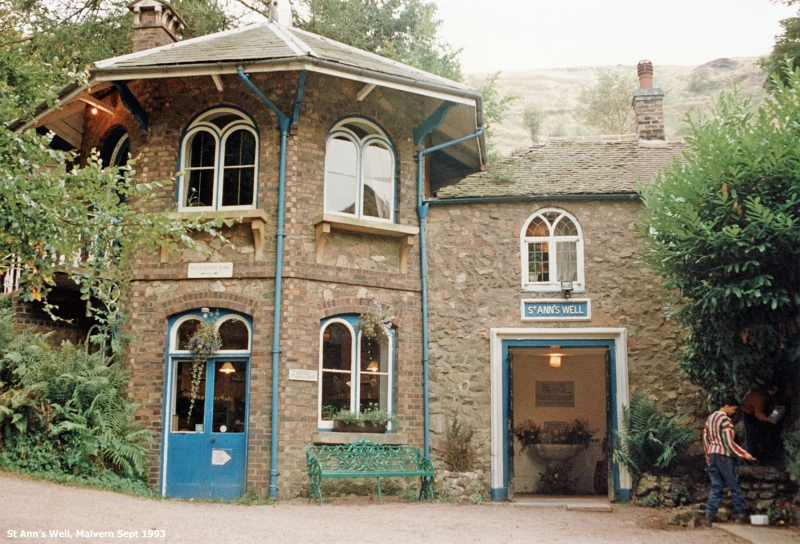
St Ann's Well
SO 7745 NW 4/28 1.1.70.
II
2.
The well-house cottage built in 1815, for the convenience of visitors to the
spa; adjoining wing added 1860.
The cottage is in random rubble with hipped old tile roof. Two storeys. Two
windows to the 1st floor, 2-light leaded wood casements with Gothick glazing
bars. Wide square-headed opening to ground floor. Spring water flows from
a marble dolphin's head into a marble scallop-shell bowl on leaf-ornamented
stem. Marble tablet with verse of 1892.
The later, taller wing is half-octagonal on plan. Two storeys in rubble with
brick and stone dressings, slate roof, wide eaves. Round-headed 2-light casements
with forked glazing bars to 1st floor, cambered-headed with round-headed lights
to ground floor. Similar head to door opening. Flight of steps with ornamental
cast-iron railings to upper floor.
Listing NGR: SO7721345794
External links are from the relevant listing authority and, where applicable, Wikidata. Wikidata IDs may be related buildings as well as this specific building. If you want to add or update a link, you will need to do so by editing the Wikidata entry.


Other nearby listed buildings
