Latitude: 53.6968 / 53°41'48"N
Longitude: -0.8766 / 0°52'35"W
OS Eastings: 474268
OS Northings: 422851
OS Grid: SE742228
Mapcode National: GBR QTBP.0J
Mapcode Global: WHFDK.HBSS
Plus Code: 9C5XM4WF+P9
Entry Name: Boat Hoist on South Side of South Dock
Listing Date: 18 April 1986
Last Amended: 15 September 1987
Grade: II*
Source: Historic England
Source ID: 1083214
English Heritage Legacy ID: 165280
ID on this website: 101083214
Location: Old Goole, East Riding of Yorkshire, DN14
County: East Riding of Yorkshire
Civil Parish: Goole
Built-Up Area: Goole
Traditional County: Yorkshire
Lieutenancy Area (Ceremonial County): East Riding of Yorkshire
Church of England Parish: Goole St John the Evangelist
Church of England Diocese: Sheffield
Tagged with: Architectural structure
GOOLE BRIDGE STREET SE 72 SW (west side, off)
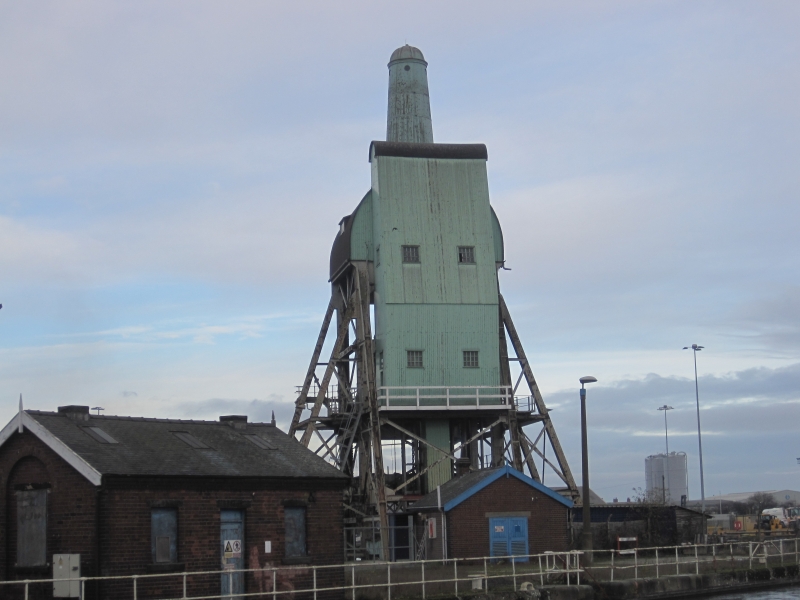
10/55 Boat hoist on south side of South Dock (formerly listed as South 18.4.86 Dock, Boat Hoist adjacent to Knottingly and Goole Canal) GV II* Boat hoist. c1862, invented by W H Bartholomew to transfer coal from canal barge coal compartments into seagoing vessels. Framework of cast-iron girders stands on ashlar abutments and carries weather-boarded cabins and turret with asphalted roofs. 5-stage tower in pyramidal form with semicircular roofed cabin to fifth stage surmounted by tapering domed turret. Tall 3-storey compartment to east side. 12-pane Yorkshire sashes to first 2 storeys. Cradle at base is submerged below compartment boat which is raised on hydraulic cylinders to third stage where cradle tipping cylinder tips compartment boat to project coal down shoot into hold of waiting vessel. Buffers and clamp rectify tipped emptied compartment which is then returned hydraulically in the cradle back to the water. Upper cabins and tower house haulage gear. The compartment boats were popularly known as Tom Puddings, hence the familiar local name for the structures is "Tom Pudding Hoists". They were peculiar to Goole and originally there were 5. Two now remain; the other is adjacent to Aldam Dock. Disused at time of resurvey. 150 Years of the Port of Goole, British Waterways Board; Waterway World, October 1983.
Listing NGR: SE7426822851
External links are from the relevant listing authority and, where applicable, Wikidata. Wikidata IDs may be related buildings as well as this specific building. If you want to add or update a link, you will need to do so by editing the Wikidata entry.


Other nearby listed buildings