Latitude: 53.6954 / 53°41'43"N
Longitude: -0.8748 / 0°52'29"W
OS Eastings: 474388
OS Northings: 422695
OS Grid: SE743226
Mapcode National: GBR QTBQ.D1
Mapcode Global: WHFDK.JCMW
Plus Code: 9C5XM4WG+53
Entry Name: Granary at Bridge Farm
Listing Date: 15 September 1987
Grade: II
Source: Historic England
Source ID: 1160326
English Heritage Legacy ID: 165289
ID on this website: 101160326
Location: Old Goole, East Riding of Yorkshire, DN14
County: East Riding of Yorkshire
Civil Parish: Goole
Built-Up Area: Goole
Traditional County: Yorkshire
Lieutenancy Area (Ceremonial County): East Riding of Yorkshire
Church of England Parish: Goole St John the Evangelist
Church of England Diocese: Sheffield
Tagged with: Granary
GOOLE COTTINGHAM STREET SE 72 SW (west side, off) 10/63 Granary at Bridge Farm
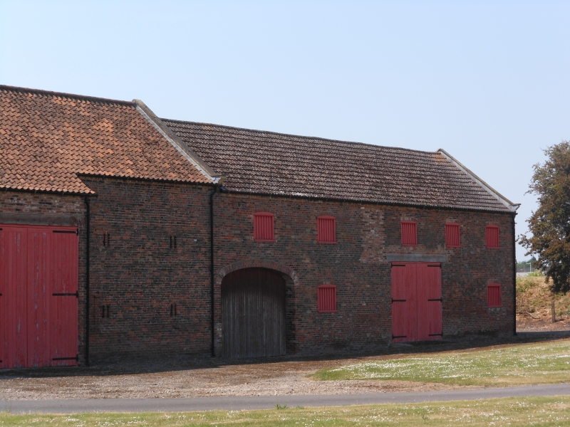
GV II Granary, forming northern section of east range of farm buildings at Bridge Farm. Late C18 with C20 alterations. Brick in English garden wall bond, concrete tiles. 2 storeys, 5 first-floor openings. Elliptical-arched cart entrance to right with round-arched board door and slatted segmental-arched opening immediately to its left. First floor: 4 blocked segmental-arched openings and a blocked pitching door to right. Gable coping and brick kneeler to left. Listed as part of an unusually unaltered and complete complex of farmbuildings.
Listing NGR: SE7438822695
External links are from the relevant listing authority and, where applicable, Wikidata. Wikidata IDs may be related buildings as well as this specific building. If you want to add or update a link, you will need to do so by editing the Wikidata entry.


Other nearby listed buildings