Latitude: 53.5865 / 53°35'11"N
Longitude: -0.655 / 0°39'18"W
OS Eastings: 489129
OS Northings: 410831
OS Grid: SE891108
Mapcode National: GBR RVVZ.Z2
Mapcode Global: WHGGC.X37V
Plus Code: 9C5XH8PV+JX
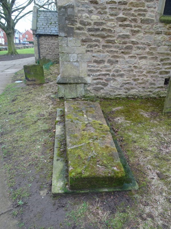
Entry Name: Grave Slab 1 Metre East of South Aisle of Church of St Lawrence
Listing Date: 28 March 1985
Grade: II
Source: Historic England
Source ID: 1083611
English Heritage Legacy ID: 166267
ID on this website: 101083611
Location: St Lawrence's Church, Scunthorpe, North Lincolnshire, DN15
County: North Lincolnshire
Electoral Ward/Division: Town
Parish: Non Civil Parish
Built-Up Area: Scunthorpe
Traditional County: Lincolnshire
Lieutenancy Area (Ceremonial County): Lincolnshire
Church of England Parish: Frodingham and New Brumby
Church of England Diocese: Lincoln
Tagged with: Grave slab
SCUNTHORPE CHURCH LANE SE 81 SE (north side) Frodingham 1/6 Grave-slab 1 metre east of south aisle - of Church of St-Lawrence GV II
Grave cover. C13 with later base and repairs. Ashlar. Coffin-shaped, flat-topped with decorative cross in relief and beaded lid carved from single slab (cracked and patched) 15 cm thick, on flat stone base. Probably re-positioned within last century.
Listing NGR: SE8912910831
External links are from the relevant listing authority and, where applicable, Wikidata. Wikidata IDs may be related buildings as well as this specific building. If you want to add or update a link, you will need to do so by editing the Wikidata entry.


Other nearby listed buildings