Approximate Location Map
Large Map »
Latitude: 51.127 / 51°7'37"N
Longitude: 0.2597 / 0°15'35"E
OS Eastings: 558223
OS Northings: 138838
OS Grid: TQ582388
Mapcode National: GBR MPZ.6HT
Mapcode Global: VHHQD.GX5Y
Plus Code: 9F3247G5+QV
Entry Name: 14 AND 14A, CHAPEL PLACE (See details for further address information)
Listing Date: 7 June 1974
Grade: II
Source: Historic England
Source ID: 1083757
English Heritage Legacy ID: 167946
ID on this website: 101083757
Location: Royal Tunbridge Wells, Tunbridge Wells, Kent, TN1
County: Kent
District: Tunbridge Wells
Electoral Ward/Division: Pantiles and St Mark's
Parish: Non Civil Parish
Built-Up Area: Royal Tunbridge Wells
Traditional County: Kent
Lieutenancy Area (Ceremonial County): Kent
Church of England Parish: Tunbridge Wells King Charles the Martyr
Church of England Diocese: Rochester
Tagged with: Building
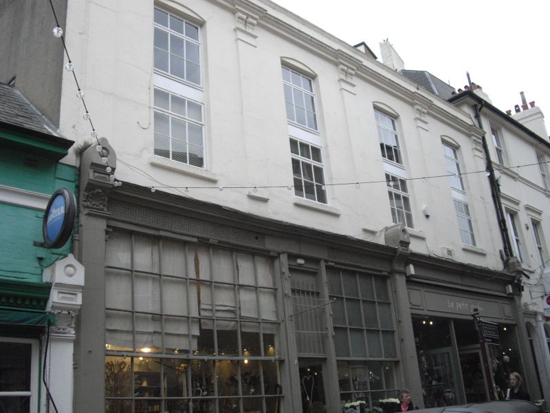
1. CHAPEL PLACE
1746
(North West Side)
Nos 14 and 14A
No 16
TQ 5838 NW 1/155
II GV
2.
Mid C19. 2 storeys cement rendered. Parapet. 5 Corinthian pilasters. 4 cambered
sashes with glazing bars intact. Left side Mid C19 shop front with rectangular
panels.
Nos 10 to 20 (even) form a group.
Listing NGR: TQ5822038837
External links are from the relevant listing authority and, where applicable, Wikidata. Wikidata IDs may be related buildings as well as this specific building. If you want to add or update a link, you will need to do so by editing the Wikidata entry.


Other nearby listed buildings
