Approximate Location Map
Large Map »
Latitude: 53.4138 / 53°24'49"N
Longitude: -2.9375 / 2°56'14"W
OS Eastings: 337784
OS Northings: 391186
OS Grid: SJ377911
Mapcode National: GBR 7GL.K7
Mapcode Global: WH877.VGC8
Plus Code: 9C5VC377+G2
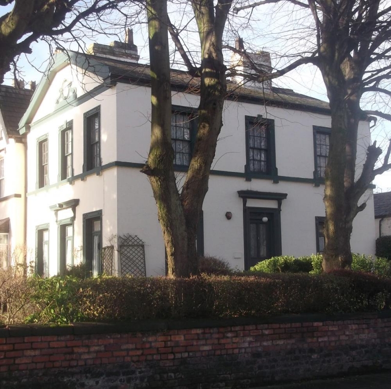
Entry Name: The Hollies
Listing Date: 19 June 1985
Grade: II
Source: Historic England
Source ID: 1209011
English Heritage Legacy ID: 359280
ID on this website: 101209011
Location: Elm Park, Liverpool, Merseyside, L6
County: Liverpool
Electoral Ward/Division: Kensington and Fairfield
Parish: Non Civil Parish
Built-Up Area: Liverpool
Traditional County: Lancashire
Lieutenancy Area (Ceremonial County): Merseyside
Church of England Parish: Liverpool, All Saints
Church of England Diocese: Liverpool
Tagged with: Architectural structure
SJ 3791 PROSPECT VALE
(West side)
L6
4/933 No 1
(The Hollies)
14.3.75.
G.V. II
House. c.1840. Stucco with slate roof. 2 storeys and 3 x 3
bays. 1st floor sill band and top cornice. Windows in
architraves with cartouches in upper angles, those to 1st
floor are shouldered. Windows are sashed with glazing bars,
except for ground floor windows, that to left is blind, that
to right has casement. Entrance in architrave with frieze
and consoled cornice, half glazed door. Facade to Prescot Rd
similar; top pediment with oval ornament flanked by scrolls.
Raking cornice is boarded over (1984).
Listing NGR: SJ3778491186
External links are from the relevant listing authority and, where applicable, Wikidata. Wikidata IDs may be related buildings as well as this specific building. If you want to add or update a link, you will need to do so by editing the Wikidata entry.


Other nearby listed buildings
