Approximate Location Map
Large Map »
Latitude: 51.3402 / 51°20'24"N
Longitude: 1.4131 / 1°24'47"E
OS Eastings: 637811
OS Northings: 165652
OS Grid: TR378656
Mapcode National: GBR X0D.XS0
Mapcode Global: VHMCW.FKXZ
Plus Code: 9F338CR7+36
Entry Name: Office Block, Retaining Walls at Flour Mills
Listing Date: 4 February 1988
Last Amended: 17 October 1988
Grade: II
Source: Historic England
Source ID: 1085349
English Heritage Legacy ID: 171888
ID on this website: 101085349
Location: Ramsgate, Thanet, Kent, CT11
County: Kent
District: Thanet
Civil Parish: Ramsgate
Built-Up Area: Ramsgate
Traditional County: Kent
Lieutenancy Area (Ceremonial County): Kent
Tagged with: Building
In the entry for
RAMSGATE MARGATE ROAD
TR 36 NE
(west side)
1/255 Office block, retaining
walls at Flour Mills
The description shall be amended to read
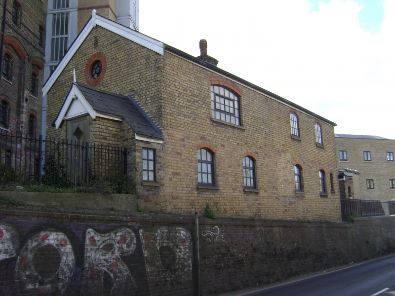
Office block, retaining walls, circa 1865 by Edward Welby Pugin. Stock brick with red brick details and slate roof. Two storey office, with gabled roof and central stack. Four segmental metal casements on each floor, and half-glazed door in porch on left gable end, with rounded over and lozenge-shaped plaque to left of door. Seven feet high retaining wall on 2 levels along road side, returned to front (south) of site where the 3 gate piers are C20 and not included. Included for group value.
------------------------------------
RAMSGATE MARGATE ROAD
TR 36 NE
(west side)
1/255 office block
retaining walls
& gates at Flour
Mills
GV II
Office block, retaining walls and gates. 1860s by Edward Welby Pugin. Stock brick with red brick details and slate roof. Two storey office, with gabled roof
and central stack. Four segmental metal casements on each floor, and half-
glazed door in porch on left gable end, with rounder over and lozenge-
shaped plaque to left of door. Seven feet high retaining wall on 2 levels
along road side, returned to front (south) of site, with 3 massive gate piers,
about 6 feet high, with rendered bands and stone pyramidal caps on
corbelling. Included for group value.
Listing NGR: TR3778165646
External links are from the relevant listing authority and, where applicable, Wikidata. Wikidata IDs may be related buildings as well as this specific building. If you want to add or update a link, you will need to do so by editing the Wikidata entry.


Other nearby listed buildings
