Latitude: 51.3361 / 51°20'9"N
Longitude: 1.4197 / 1°25'10"E
OS Eastings: 638291
OS Northings: 165218
OS Grid: TR382652
Mapcode National: GBR X0L.5QX
Mapcode Global: VHMCW.KPD4
Plus Code: 9F338CP9+CV
Entry Name: Nos 56 and 58 and Railed Areas
Listing Date: 4 February 1988
Grade: II
Source: Historic England
Source ID: 1085384
English Heritage Legacy ID: 171786
ID on this website: 101085384
Location: Ramsgate, Thanet, Kent, CT11
County: Kent
District: Thanet
Civil Parish: Ramsgate
Built-Up Area: Ramsgate
Traditional County: Kent
Lieutenancy Area (Ceremonial County): Kent
Tagged with: Building
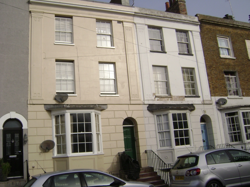
RAMSGATE HARDRES STREET
TR 3865 SW
(north west side)
9/157
Nos. 56 & 58
and railed areas
GV II
House pair. 1830's. Rendered with slate roof. Three storeys and basement
with rusticated ground floor and plat band with 4 Greek-key incised giant
pilasters to frieze and cornice with parapet and stack to centre and to
right. Regular fenestration of 4 glazing bar sashes to 2nd and 1st floors,
with canted bays on ground floor with fluted pilasters and cornice and
glazing bar sashes. Doors to right, half glazed to No. 56. The original
reeded and panelled door to No. 58, with round-headed surrounds and
Anthemion pattern keystones. Simple rails to steps, and Gothic pattern
rails to basement areas.
Listing NGR: TR3828765216
External links are from the relevant listing authority and, where applicable, Wikidata. Wikidata IDs may be related buildings as well as this specific building. If you want to add or update a link, you will need to do so by editing the Wikidata entry.


Other nearby listed buildings