Approximate Location Map
Large Map »
Latitude: 51.3322 / 51°19'56"N
Longitude: 1.4116 / 1°24'41"E
OS Eastings: 637750
OS Northings: 164764
OS Grid: TR377647
Mapcode National: GBR X0L.HQ2
Mapcode Global: VHMCW.FS32
Plus Code: 9F338CJ6+VJ
Entry Name: Stable and Coachhouse About 20 Metres North East of No 20
Listing Date: 4 February 1988
Grade: II
Source: Historic England
Source ID: 1086067
English Heritage Legacy ID: 172031
ID on this website: 101086067
Location: Ramsgate, Thanet, Kent, CT11
County: Kent
District: Thanet
Civil Parish: Ramsgate
Built-Up Area: Ramsgate
Traditional County: Kent
Lieutenancy Area (Ceremonial County): Kent
Tagged with: Stable
RAMSGATE VALE SQUARE
TR 3764 NE
(north side)
12/395 Stable and
coachhouse
about 20 metres
north east of
No. 20
GV II
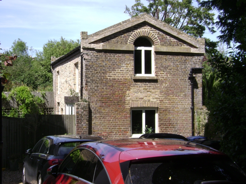
Stable and coachhouse, now garage. 1840's. Stock brick and slate
roof. One storey, with rendered pedimented end gables, with round
headed lights breaking into pediments. Entrance front with carriage
doors to right, boarded door to left with rectangular fanlight, and
wooden casement and door openings, are blocked to centre. Included
for group value, as originally stable and carriage house to No. 20 Vale
Square (item 12/394).
Listing NGR: TR3775064764
External links are from the relevant listing authority and, where applicable, Wikidata. Wikidata IDs may be related buildings as well as this specific building. If you want to add or update a link, you will need to do so by editing the Wikidata entry.


Other nearby listed buildings
