Latitude: 54.162 / 54°9'43"N
Longitude: -3.0718 / 3°4'18"W
OS Eastings: 330112
OS Northings: 474548
OS Grid: SD301745
Mapcode National: GBR 6NZ9.RT
Mapcode Global: WH72C.SNF7
Plus Code: 9C6R5W6H+Q7
Entry Name: Church of Holy Trinity
Listing Date: 5 March 1990
Grade: II
Source: Historic England
Source ID: 1086800
English Heritage Legacy ID: 75882
Also known as: Holy Trinity Church, Bardsea
ID on this website: 101086800
Location: Holy Trinity Church, Bardsea, Westmorland and Furness, Cumbria, LA12
County: Westmorland and Furness
District: South Lakeland
Civil Parish: Urswick
Traditional County: Lancashire
Lieutenancy Area (Ceremonial County): Cumbria
Church of England Parish: Bardsea Holy Trinity
Church of England Diocese: Carlisle
Tagged with: Church building
SD 37 SW URSWICK BARDSEA
19/108 Church of Holy Trinity
II
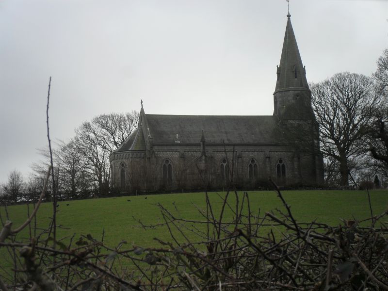
Church. 1843-53. By G. Webster. Dressed stone with rock-faced stone base, ashlar dressings and slate roof. Nave with north vestry, east apse and west tower and spire. 5-bay nave has weathered buttresses and corbel table. 2-light traceried windows and sill course. Gabled south porch has clasping buttresses and pointed entrance with niche over. North vestry is similar, with chimney in form of open pinnacle to gable end. Canted abse has battered base, nook shafts and Lombard frieze. 3 traceried lights. Tower has angle buttresses and 2-light west window. Lower part of spire is splayed with 2-light windows; upper part of spire slopes at shallower angle, with lucarnes. Interior has chancel arch with responds. Apse has nook shafts and ribbed ceiling. Good C20 stained glass to apse windows by Wilhelmina Geddes (1955); C19 glass to other windows, some by Shriggley and Hunt. Octagonal stone font; original pews, some with poppy head. Pulpit has arcading to sides; arcaded chancel rail. The church is a prominent landmark on the coast of Morecambe bay.
Listing NGR: SD3011274548
External links are from the relevant listing authority and, where applicable, Wikidata. Wikidata IDs may be related buildings as well as this specific building. If you want to add or update a link, you will need to do so by editing the Wikidata entry.


Other nearby listed buildings