Approximate Location Map
Large Map »
Latitude: 54.2009 / 54°12'3"N
Longitude: -2.9537 / 2°57'13"W
OS Eastings: 337884
OS Northings: 478769
OS Grid: SD378787
Mapcode National: GBR 7MTV.BV
Mapcode Global: WH83C.LNPW
Plus Code: 9C6V622W+9G
Entry Name: Church Bridge
Listing Date: 15 February 1989
Grade: II
Source: Historic England
Source ID: 1087168
English Heritage Legacy ID: 77003
ID on this website: 101087168
Location: Cartmel, Westmorland and Furness, Cumbria, LA11
County: Cumbria
District: South Lakeland
Civil Parish: Lower Allithwaite
Traditional County: Lancashire
Lieutenancy Area (Ceremonial County): Cumbria
Church of England Parish: Cartmel St Mary and St Michael
Church of England Diocese: Carlisle
Tagged with: Bridge
LOWER ALLITHWAITE THE SQUARE
SD 3778
Cartmel
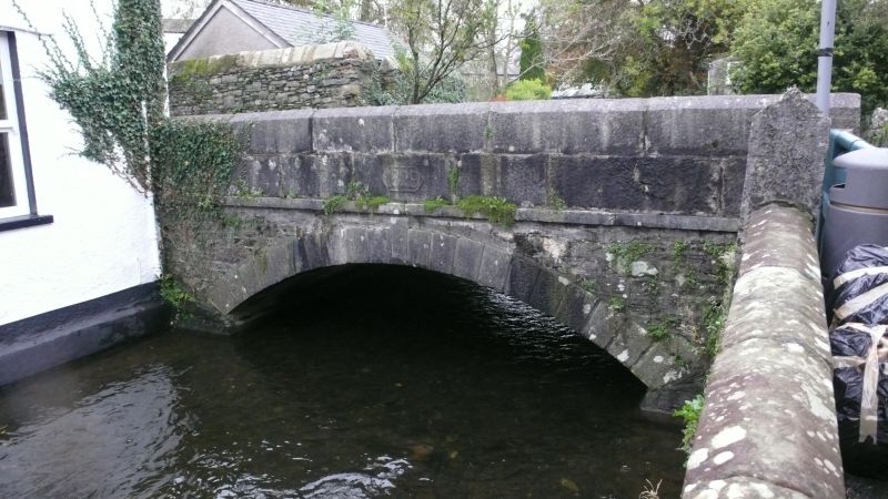
8/89 Church Bridge
G.V. II
Bridge. Dated 1829. Dressed stone and ashlar. Segmental arch with ashlar
voussoirs and key; band above. Ashlar parapet with date to south side of south
parapet. South side of north parapet inscribed; "C.C. CHURCH BRIDGE".
Listing NGR: SD3788678770
External links are from the relevant listing authority and, where applicable, Wikidata. Wikidata IDs may be related buildings as well as this specific building. If you want to add or update a link, you will need to do so by editing the Wikidata entry.


Other nearby listed buildings
