Approximate Location Map
Large Map »
Latitude: 53.2684 / 53°16'6"N
Longitude: -1.3522 / 1°21'7"W
OS Eastings: 443304
OS Northings: 374800
OS Grid: SK433748
Mapcode National: GBR MZ0N.12
Mapcode Global: WHDFB.63CP
Plus Code: 9C5W7J9X+94
Entry Name: 38 and 40, High Street
Listing Date: 26 March 1974
Grade: II
Source: Historic England
Source ID: 1088318
English Heritage Legacy ID: 83265
ID on this website: 101088318
Location: Staveley, Chesterfield, Derbyshire, S43
County: Derbyshire
District: Chesterfield
Civil Parish: Staveley
Built-Up Area: Staveley
Traditional County: Derbyshire
Lieutenancy Area (Ceremonial County): Derbyshire
Church of England Parish: Staveley St John the Baptist
Church of England Diocese: Derby
Tagged with: Building
HIGH STREET
1.
1675A
(East Side)
Nos 38 & 40
SK 4374 1/10
II GV
2.
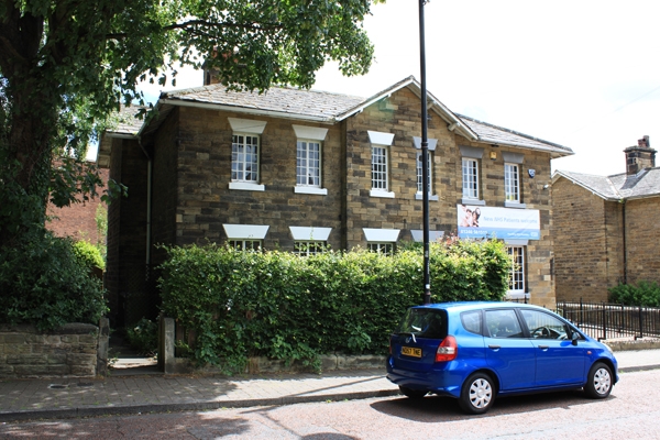
Circa 1845. Stone; 2 storeys; gabled projection at centre; 2+2+2 casement
windows with plain lintels; plain recessed doorway;projecting eaves;
stone stacks; hipped slate roof.
Nos 34 to 44 (even) form a group.
Listing NGR: SK4330474800
External links are from the relevant listing authority and, where applicable, Wikidata. Wikidata IDs may be related buildings as well as this specific building. If you want to add or update a link, you will need to do so by editing the Wikidata entry.


Other nearby listed buildings
