Approximate Location Map
Large Map »
Latitude: 53.2689 / 53°16'7"N
Longitude: -1.3514 / 1°21'5"W
OS Eastings: 443352
OS Northings: 374847
OS Grid: SK433748
Mapcode National: GBR MZ0M.6X
Mapcode Global: WHDFB.63QC
Plus Code: 9C5W7J9X+GC
Entry Name: Churchyard Cross
Listing Date: 25 February 1966
Grade: II
Source: Historic England
Source ID: 1088355
English Heritage Legacy ID: 83258
ID on this website: 101088355
Location: St John the Baptist's Church, Staveley, Chesterfield, Derbyshire, S43
County: Derbyshire
District: Chesterfield
Civil Parish: Staveley
Built-Up Area: Staveley
Traditional County: Derbyshire
Lieutenancy Area (Ceremonial County): Derbyshire
Church of England Parish: Staveley St John the Baptist
Church of England Diocese: Derby
Tagged with: Churchyard cross
1.
1675A
SK 4374
1/2
25.2.66
CHURCH STREET
(North Side)
Churchyard Cross
II
GV
2.
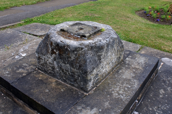
A plain medieval cross on steps. Restored.
St John's Church, Churchyard Cross. The School, Staveley Hall, Former
stables and coach house of Staveley Hall and Garden Walls of Staveley
Hall form a group.
Listing NGR: SK4335274847
External links are from the relevant listing authority and, where applicable, Wikidata. Wikidata IDs may be related buildings as well as this specific building. If you want to add or update a link, you will need to do so by editing the Wikidata entry.


Other nearby listed buildings
