Latitude: 52.8605 / 52°51'37"N
Longitude: -1.4603 / 1°27'37"W
OS Eastings: 436433
OS Northings: 329354
OS Grid: SK364293
Mapcode National: GBR 6FN.PM3
Mapcode Global: WHDH6.JCVG
Plus Code: 9C4WVG6Q+5V
Entry Name: Lowes Farmhouse and Attached Farm Buildings
Listing Date: 11 March 1987
Grade: II
Source: Historic England
Source ID: 1088349
English Heritage Legacy ID: 83238
ID on this website: 101088349
Location: Swarkestone, South Derbyshire, DE73
County: Derbyshire
District: South Derbyshire
Civil Parish: Swarkestone
Traditional County: Derbyshire
Lieutenancy Area (Ceremonial County): Derbyshire
Church of England Parish: Swarkestone St James
Church of England Diocese: Derby
Tagged with: Farmhouse
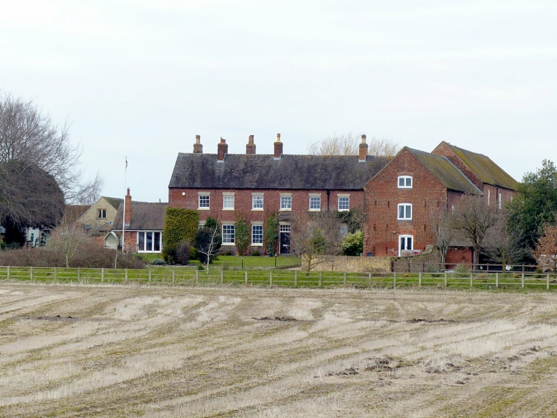
SK 32 NE PARISH OF SWARKESTONE LOWES LANE 3/251 (West Side) Lowes Farmhouse and attached Farm Buildings II Farmhouse and attached farmbuildings. Early C19 with minor later alterations. Red brick with stone dressings and plain tile roof with three brick ridge stacks, plus dentilled eaves band. Two storey nine bay range to north, of which seven to west form the present farmhouse, with six bay, two storey range at right angles to east, plus lower threshing barn to south end. Farmhouse has a flush panelled door and plain overlight below wedge stone lintel with bottom edge slightly arched to either side of central keystone. To west there are three glazing bar sashes below similar lintels, that to far west lengthened, and to east there are two similar windows. Above there are seven similar, shallower windows. Two bays to east and the five northern bays of the east range have openings on both floors with similar lintels. Some of these openings are now blocked or used as doors. To south end of the two storey part there is a blocked gauged brick segmental arch with stone imposts and keyblock, and beyond to south the threshing barn has a similar tall opening to centre with slit breathers to either side.
Listing NGR: SK3643329354
External links are from the relevant listing authority and, where applicable, Wikidata. Wikidata IDs may be related buildings as well as this specific building. If you want to add or update a link, you will need to do so by editing the Wikidata entry.


Other nearby listed buildings