Approximate Location Map
Large Map »
Latitude: 51.6381 / 51°38'17"N
Longitude: -2.1583 / 2°9'29"W
OS Eastings: 389139
OS Northings: 193263
OS Grid: ST891932
Mapcode National: GBR 1P0.74Q
Mapcode Global: VH95K.J3V2
Plus Code: 9C3VJRQR+6M
Entry Name: 24, the Chipping
Listing Date: 6 September 1954
Grade: II
Source: Historic England
Source ID: 1089656
English Heritage Legacy ID: 128410
ID on this website: 101089656
Location: Tetbury, Cotswold, Gloucestershire, GL8
County: Gloucestershire
District: Cotswold
Civil Parish: Tetbury
Built-Up Area: Tetbury
Traditional County: Gloucestershire
Lieutenancy Area (Ceremonial County): Gloucestershire
Church of England Parish: Tetbury St Mary the Virgin
Church of England Diocese: Gloucester
Tagged with: Building
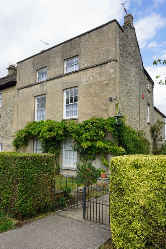
ST 8893-8993 TETBURY THE CHIPPING
(north side)
7/134 No 24
6.9.54
GV II
House. Mid C18. Rubble stone faced with render, Cotswold stone
slate roof with parapet and 2 small stone end stacks, continuous
rendered quoin strips incised on ground floor, and plain bands at
floor levels. Front range and 2 lower hipped ranges to rear. 3
storeys. 2 windows, 12-pane sashes, to each floor with door on
right return in plain semi-circular head reveal. C20 panelled
door.
Listing NGR: ST8919493348
External links are from the relevant listing authority and, where applicable, Wikidata. Wikidata IDs may be related buildings as well as this specific building. If you want to add or update a link, you will need to do so by editing the Wikidata entry.


Other nearby listed buildings
