Approximate Location Map
Large Map »
Latitude: 51.7807 / 51°46'50"N
Longitude: -2.3566 / 2°21'23"W
OS Eastings: 375495
OS Northings: 209172
OS Grid: SO754091
Mapcode National: GBR 0KN.C0P
Mapcode Global: VH94P.3HJS
Plus Code: 9C3VQJJV+79
Entry Name: Milestone at National Grid Reference So 755 092
Listing Date: 30 November 1989
Grade: II
Source: Historic England
Source ID: 1091310
English Heritage Legacy ID: 132553
ID on this website: 101091310
Location: Saul, Stroud, Gloucestershire, GL2
County: Gloucestershire
District: Stroud
Civil Parish: Fretherne with Saul
Traditional County: Gloucestershire
Lieutenancy Area (Ceremonial County): Gloucestershire
Church of England Parish: Saul St James the Great
Church of England Diocese: Gloucester
Tagged with: Milestone
SO 70 NE
6/286
FRETHERNE WITH SAUL
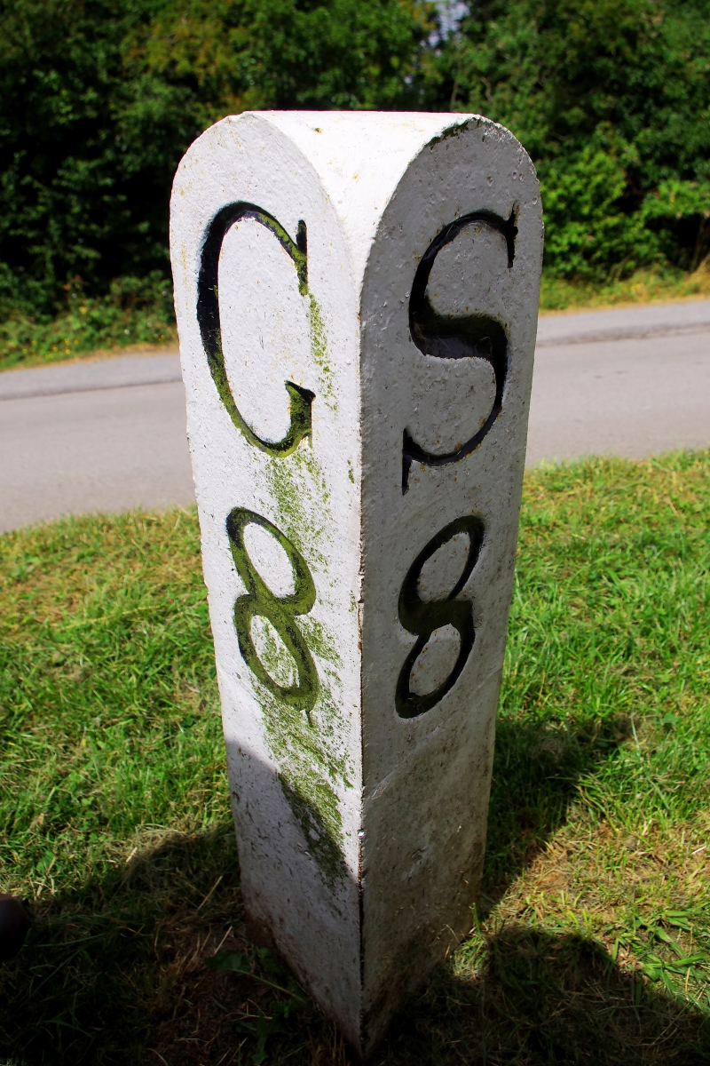
GLOUCESTER AND SHARPNESS CANAL
Milepost at NGR SO 755 092
II
Canal milepost. Circa 1827. Painted, triangular stone post with rounded top.
Incised serif lettering and numbers: On left face, G8; on right face, S8.
Listing NGR: SO7549509172
External links are from the relevant listing authority and, where applicable, Wikidata. Wikidata IDs may be related buildings as well as this specific building. If you want to add or update a link, you will need to do so by editing the Wikidata entry.


Other nearby listed buildings
