Approximate Location Map
Large Map »
Latitude: 51.3877 / 51°23'15"N
Longitude: 1.3811 / 1°22'52"E
OS Eastings: 635343
OS Northings: 170834
OS Grid: TR353708
Mapcode National: GBR WZS.VC7
Mapcode Global: VHLG6.WDJ0
Plus Code: 9F3399QJ+3F
Entry Name: 14 and 15, Cecil Square
Listing Date: 22 February 1973
Grade: II
Source: Historic England
Source ID: 1088992
English Heritage Legacy ID: 356507
ID on this website: 101088992
Location: Margate, Thanet, Kent, CT9
County: Kent
District: Thanet
Electoral Ward/Division: Margate Central
Parish: Non Civil Parish
Built-Up Area: Margate
Traditional County: Kent
Lieutenancy Area (Ceremonial County): Kent
Tagged with: Building
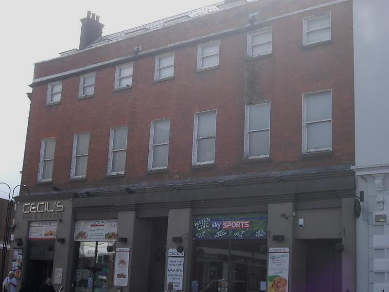
CECIL SQUARE
1.
1380
(West Side)
Nos 14 and 15
TR 3570 NW 1/25
II GV
2.
Circa 1769. 3 storeys and basement with area. Red brick. Modern attic storey
added containing 7 dormer windows. 7 windows in all. Modern shopfronts. Now
forms part of Bobby's store extending into High Street.
Nos 1 to 5 (odd) and Nos 6 to 15 (consec) form a group
Listing NGR: TR3534370834
External links are from the relevant listing authority and, where applicable, Wikidata. Wikidata IDs may be related buildings as well as this specific building. If you want to add or update a link, you will need to do so by editing the Wikidata entry.


Other nearby listed buildings
