Latitude: 51.3899 / 51°23'23"N
Longitude: 1.3835 / 1°23'0"E
OS Eastings: 635493
OS Northings: 171081
OS Grid: TR354710
Mapcode National: GBR WZS.W04
Mapcode Global: VHLG6.XBRC
Plus Code: 9F3399QM+W9
Entry Name: 29 and 31, King Street
Listing Date: 15 December 1970
Grade: II
Source: Historic England
Source ID: 1094644
English Heritage Legacy ID: 356598
ID on this website: 101094644
Location: Margate, Thanet, Kent, CT9
County: Kent
District: Thanet
Electoral Ward/Division: Margate Central
Parish: Non Civil Parish
Built-Up Area: Margate
Traditional County: Kent
Lieutenancy Area (Ceremonial County): Kent
Tagged with: Building
This list entry was subject to a Minor Amendment on 13 November 2025 to correct a typo in the description and to reformat the text to current standards
TR 3571 SW
2/213
KING STREET (North Side)
Nos 29 and 31
15.12.70.
GV
II
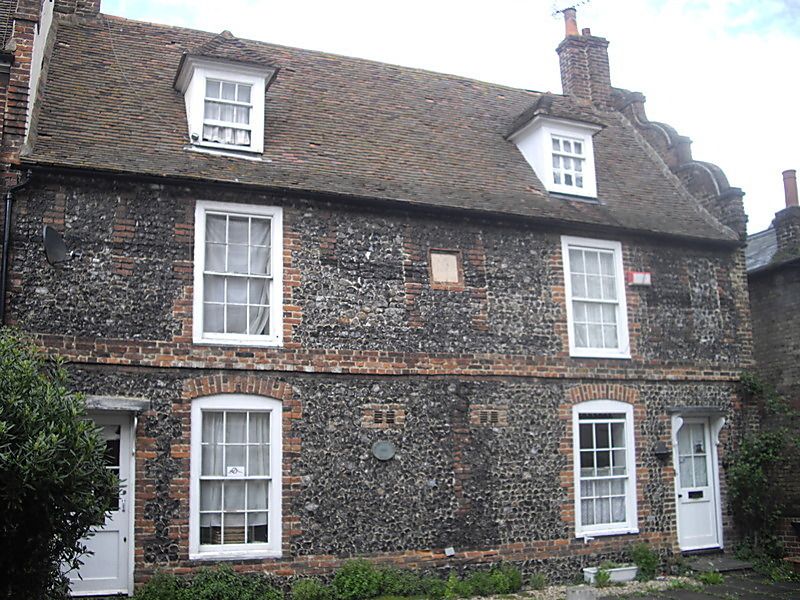
Probably C17 and later. Two storeys flint-faced with brick quoins and stringcourse. Old tiled roof with two restored stacks. Modern office front on ground floor.
Nos 15 to 35 (odd) and No 91 Trinity Square form a group
Listing NGR: TR3549371081
External links are from the relevant listing authority and, where applicable, Wikidata. Wikidata IDs may be related buildings as well as this specific building. If you want to add or update a link, you will need to do so by editing the Wikidata entry.


Other nearby listed buildings