Latitude: 51.3899 / 51°23'23"N
Longitude: 1.3834 / 1°23'0"E
OS Eastings: 635486
OS Northings: 171086
OS Grid: TR354710
Mapcode National: GBR WZS.W04
Mapcode Global: VHLG6.XBPB
Plus Code: 9F3399QM+X8
Entry Name: 27, King Street
Listing Date: 15 December 1970
Grade: II
Source: Historic England
Source ID: 1203723
English Heritage Legacy ID: 356597
ID on this website: 101203723
Location: Margate, Thanet, Kent, CT9
County: Kent
District: Thanet
Electoral Ward/Division: Margate Central
Parish: Non Civil Parish
Built-Up Area: Margate
Traditional County: Kent
Lieutenancy Area (Ceremonial County): Kent
Tagged with: Building
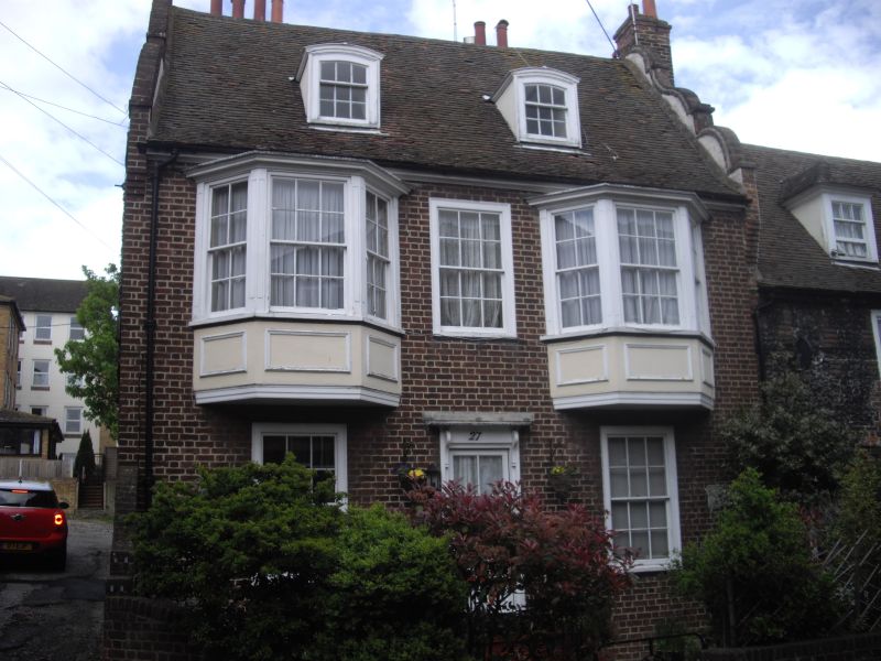
KING STREET
1.
1380
(North Side)
No 27
TR 3571 SW 2/212 15.12.70.
II GV
2.
Early C18. L-shaped. 2 storeys stock brick. Curved gable at end. Tiled roof
with 2 hipped dormers. 1st floor has 2 canted bays. Ground floor has had a
modern office front built on. Side elevation is of lower elevation with
segmental window openings.
Nos 15 to 35 (odd) and No 91 Trinity Square form a group
Listing NGR: TR3548671086
External links are from the relevant listing authority and, where applicable, Wikidata. Wikidata IDs may be related buildings as well as this specific building. If you want to add or update a link, you will need to do so by editing the Wikidata entry.


Other nearby listed buildings