Latitude: 52.8128 / 52°48'46"N
Longitude: -1.4801 / 1°28'48"W
OS Eastings: 435140
OS Northings: 324043
OS Grid: SK351240
Mapcode National: GBR 6G6.QM0
Mapcode Global: WHDHD.7KGH
Plus Code: 9C4WRG79+4X
Entry Name: Ruins of Old Parish Church, West Part
Listing Date: 19 January 1967
Last Amended: 6 January 1987
Grade: II
Source: Historic England
Source ID: 1096472
English Heritage Legacy ID: 82888
ID on this website: 101096472
Location: St George's Church, Ticknall, South Derbyshire, DE73
County: Derbyshire
District: South Derbyshire
Civil Parish: Ticknall
Built-Up Area: Ticknall
Traditional County: Derbyshire
Lieutenancy Area (Ceremonial County): Derbyshire
Church of England Parish: Ticknall St George
Church of England Diocese: Derby
Tagged with: Church ruin
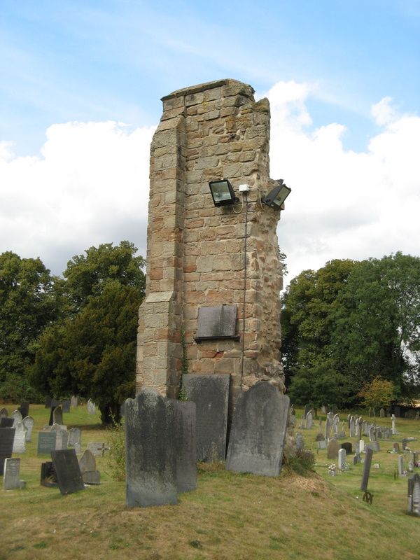
PARISH OF TICKNALL CHURCH LANE SK 32 SE 4/82 Ruins of Old Parish 19-1-67 Church, West Part (formerly listed as one item with item 4/81) GV II Fragment of the old parish church, c45 yards south of the south porch of the new church. Probably c1300. Coursed squared sandstone and ashlar. The north west angle of the former west tower stands to about twenty feet in height. Angle buttresses with two set-offs. The jamb and first three voussoirs of a double chamfered four-centred arched window survives. This church was blown up c1840 when the new church was built to the north.
Listing NGR: SK3514024043
External links are from the relevant listing authority and, where applicable, Wikidata. Wikidata IDs may be related buildings as well as this specific building. If you want to add or update a link, you will need to do so by editing the Wikidata entry.


Other nearby listed buildings