Approximate Location Map
Large Map »
Latitude: 53.3477 / 53°20'51"N
Longitude: -1.7426 / 1°44'33"W
OS Eastings: 417231
OS Northings: 383451
OS Grid: SK172834
Mapcode National: GBR JY8Q.JN
Mapcode Global: WHCCM.63FY
Plus Code: 9C5W87X4+3X
Entry Name: Remains of Churchyard Cross, 3 Metres South of St Peter's Church
Listing Date: 21 April 1967
Grade: II
Source: Historic England
Source ID: 1096622
English Heritage Legacy ID: 82530
ID on this website: 101096622
Location: St Peter's Church, Hope, High Peak, Derbyshire, S33
County: Derbyshire
District: High Peak
Civil Parish: Hope
Built-Up Area: Hope
Traditional County: Derbyshire
Lieutenancy Area (Ceremonial County): Derbyshire
Church of England Parish: Hope St Peter
Church of England Diocese: Derby
SK 18 SE PARISH OF HOPE CASTLETON ROAD
7/70 (South Side)
21.4.67 Remains of Churchyard Cross,
3m south of St Peter's Church
GV II
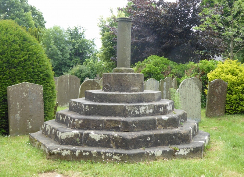
Base of Medieval cross raised on five steps and surmounted by C20 shaft. Gritstone
Base of cross and steps polygonal in plan. Circular shaft.
Listing NGR: SK1723183451
External links are from the relevant listing authority and, where applicable, Wikidata. Wikidata IDs may be related buildings as well as this specific building. If you want to add or update a link, you will need to do so by editing the Wikidata entry.


Other nearby listed buildings
