Approximate Location Map
Large Map »
Latitude: 53.3477 / 53°20'51"N
Longitude: -1.7426 / 1°44'33"W
OS Eastings: 417230
OS Northings: 383459
OS Grid: SK172834
Mapcode National: GBR JY8Q.JN
Mapcode Global: WHCCM.63FW
Plus Code: 9C5W87X4+3W
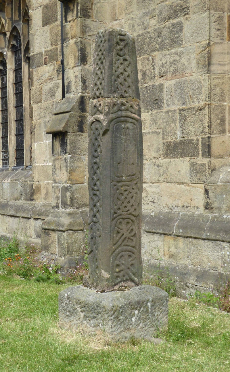
Entry Name: Cross Shaft 1 Metre South of St Peters Church
Listing Date: 21 April 1967
Grade: II
Source: Historic England
Source ID: 1121949
English Heritage Legacy ID: 82531
ID on this website: 101121949
Location: St Peter's Church, Hope, High Peak, Derbyshire, S33
County: Derbyshire
District: High Peak
Civil Parish: Hope
Built-Up Area: Hope
Traditional County: Derbyshire
Lieutenancy Area (Ceremonial County): Derbyshire
Church of England Parish: Hope St Peter
Church of England Diocese: Derby
SK 18 SE PARISH OF HOPE CASTLETON ROAD
7/71 (South Side)
21.4.67 Cross shaft 1m south of St
Peter's Church
GV II
Cross shaft. C11. Gritstone with Saxon interlace decoration and pairs of figures
on the east and west faces, reset on square C20 base.
Listing NGR: SK1723083459
External links are from the relevant listing authority and, where applicable, Wikidata. Wikidata IDs may be related buildings as well as this specific building. If you want to add or update a link, you will need to do so by editing the Wikidata entry.


Other nearby listed buildings
