Latitude: 52.3383 / 52°20'17"N
Longitude: -2.0935 / 2°5'36"W
OS Eastings: 393724
OS Northings: 271137
OS Grid: SO937711
Mapcode National: GBR 2FW.CJD
Mapcode Global: VH923.NHLB
Plus Code: 9C4V8WQ4+8H
Entry Name: Monsieurs Hall
Listing Date: 28 April 1952
Grade: II
Source: Historic England
Source ID: 1100357
English Heritage Legacy ID: 155722
ID on this website: 101100357
Location: Park Gate, Bromsgrove, Worcestershire, B61
County: Worcestershire
District: Bromsgrove
Civil Parish: Dodford with Grafton
Traditional County: Worcestershire
Lieutenancy Area (Ceremonial County): Worcestershire
Church of England Parish: Dodford Holy Trinity
Church of England Diocese: Worcester
Tagged with: Building
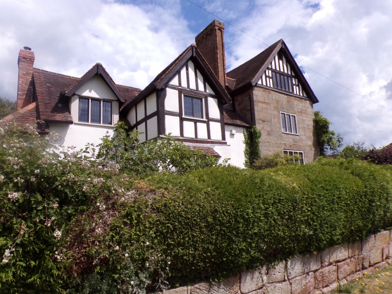
KIDDERMINSTER ROAD 1. 909 Monsieurs Hall SO 97 SW 7/105 28.4.52. II GV 2. C17 farmhouse. Walls mainly of large sandstones blocks. Right hand gabled wing has weathered plinth and set back at first floor. Rectangular chimney shaft of early bricks relieved with band of small arches below cap. Smaller projecting, 2 storey gabled wing to left hand side with stone chimney stack having two diagonal shafts of early bricks. C18 alterations in red brickwork. Simple 6-panel door and hood. Gable heads to front (west) elevation have been rendered in cement but those to the rear have timber framing exposed. Two 3-light mullioned and splayed doorway on south side. Remainder of windows, simple casements in roof, frames are later insertions. Stone gate piers with moulded cornice and ball finials. Monsieurs Hall the Barn and Outbuilding form a group.
Listing NGR: SO9372471137
External links are from the relevant listing authority and, where applicable, Wikidata. Wikidata IDs may be related buildings as well as this specific building. If you want to add or update a link, you will need to do so by editing the Wikidata entry.


Other nearby listed buildings