Approximate Location Map
Large Map »
Latitude: 52.3381 / 52°20'17"N
Longitude: -2.0931 / 2°5'35"W
OS Eastings: 393753
OS Northings: 271121
OS Grid: SO937711
Mapcode National: GBR 2FW.KLN
Mapcode Global: VH923.NHTF
Plus Code: 9C4V8WQ4+7Q
Entry Name: Barn South East of Monsieurs Hall
Listing Date: 28 April 1952
Grade: II
Source: Historic England
Source ID: 1348485
English Heritage Legacy ID: 155723
ID on this website: 101348485
Location: Park Gate, Bromsgrove, Worcestershire, B61
County: Worcestershire
District: Bromsgrove
Civil Parish: Dodford with Grafton
Traditional County: Worcestershire
Lieutenancy Area (Ceremonial County): Worcestershire
Church of England Parish: Dodford Holy Trinity
Church of England Diocese: Worcester
Tagged with: Barn
KIDDERMINSTER ROAD
1.
909
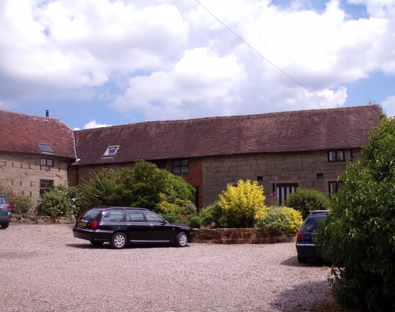
Barn South East of
Monsieurs Hall
SO 97 SW 7/106 28.4.52.
II GV
2.
Probably C18. Sandstone blocks with old tile and machine tile roofs. Two
adjoining barns forming L shape plan. Included for group value.
Monsieurs Hall the Barn and Outbuilding form a group.
Listing NGR: SO9375371121
External links are from the relevant listing authority and, where applicable, Wikidata. Wikidata IDs may be related buildings as well as this specific building. If you want to add or update a link, you will need to do so by editing the Wikidata entry.


Other nearby listed buildings
