Latitude: 51.7618 / 51°45'42"N
Longitude: -0.2114 / 0°12'41"W
OS Eastings: 523532
OS Northings: 208522
OS Grid: TL235085
Mapcode National: GBR J9M.FCM
Mapcode Global: VHGPL.9Z29
Plus Code: 9C3XQQ6Q+PC
Entry Name: Numbers 2 and 4, Comprising the Chaplains House and Flats Numbers 1, 2, 3, 4 (The Gate House) and 5, and Including East Wall
Listing Date: 3 April 1951
Grade: II
Source: Historic England
Source ID: 1101051
English Heritage Legacy ID: 158380
ID on this website: 101101051
Location: Old Hatfield, Welwyn Hatfield, Hertfordshire, AL9
County: Hertfordshire
District: Welwyn Hatfield
Civil Parish: Hatfield
Built-Up Area: Hatfield
Traditional County: Hertfordshire
Lieutenancy Area (Ceremonial County): Hertfordshire
Church of England Parish: Bishops Hatfield Saint Etheldreda with Saint Luke
Church of England Diocese: St.Albans
Tagged with: Building
Old Hatfield TL 2308 HATFIELD FORE STREET (north side)
15/117 Nos 2 and 4, comprising The Chaplains House and flats nos 1, 2, 3.4.51 3, 4 (The Gate House) and 5, and including E wall.
GV II
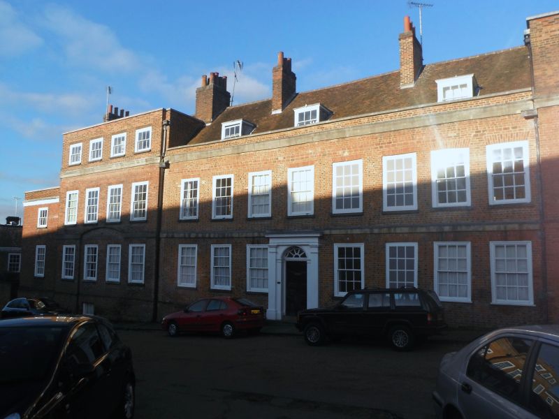
Formerly The Salisbury Arms Hotel, now town houses. Mid C18 centre. Late C18 or early C19 fronts to left and right shallow end projections. Chequered red brick centre, plain brick ends. 4:8:3 flush sash windows with architrave frames. Centre is 2 storeys with low parapet and 3 box dormers. Central door with semicircular radiating fan, Roman Doric pilaster surround and dentil cornice. Stucco floor band and cornice band, the latter continuing on to end bays. These have attic windows in tall parapets and segmental-headed ground floor relieving arches. C20 2-storey extension on W. E end has early C19 crenellated wall with gauged brick coach entrance.
Listing NGR: TL2353208522
External links are from the relevant listing authority and, where applicable, Wikidata. Wikidata IDs may be related buildings as well as this specific building. If you want to add or update a link, you will need to do so by editing the Wikidata entry.


Other nearby listed buildings