Latitude: 51.8987 / 51°53'55"N
Longitude: -2.0706 / 2°4'14"W
OS Eastings: 395241
OS Northings: 222242
OS Grid: SO952222
Mapcode National: GBR 2M4.Z78
Mapcode Global: VHB1Q.2J7T
Plus Code: 9C3VVWXH+FQ
Entry Name: 28 and 30, Grosvenor Street
Listing Date: 14 December 1983
Grade: II
Source: Historic England
Source ID: 1104301
English Heritage Legacy ID: 474668
ID on this website: 101104301
Location: Cheltenham, Gloucestershire, GL52
County: Gloucestershire
District: Cheltenham
Electoral Ward/Division: All Saints
Parish: Non Civil Parish
Built-Up Area: Cheltenham
Traditional County: Gloucestershire
Lieutenancy Area (Ceremonial County): Gloucestershire
Church of England Parish: Cheltenham All Saints (Pittville)
Church of England Diocese: Gloucester
Tagged with: Building
CHELTENHAM
SO9522SW GROSVENOR STREET 630-1/14/359 (West side) 14/12/83 Nos.28 AND 30
GV II
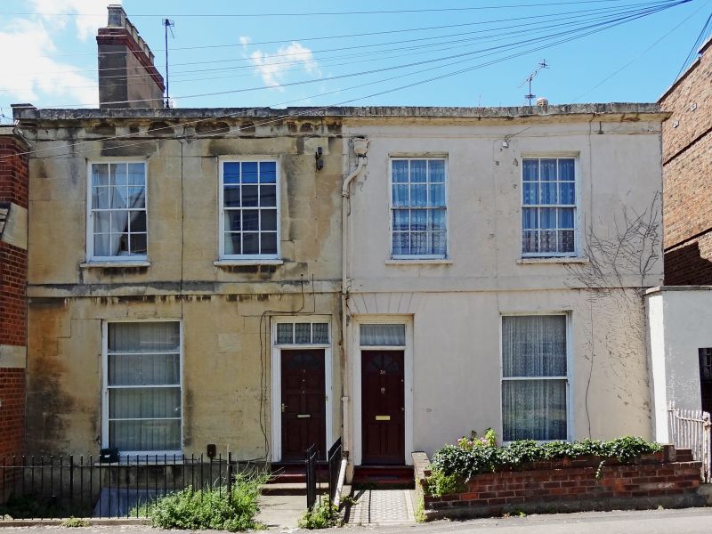
Pair of terraced houses. c1820-34. Ashlar over brick (painted to right) with tall stucco and brick stack to left. EXTERIOR: 2 storeys, 4 first-floor windows (2:2). 6/6 sashes to first floor, 2/2 horizontal-pane and 1/1 tall sashes to ground floor, in plain reveals and with sills. Central entrances, 4-panel doors where original with overlight, that to left with glazing bars, voussoirs to right. First-floor band, frieze and cornice with blocking course. INTERIOR: not inspected. HISTORICAL NOTE: Grosvenor Street is apparently shown as Gyde's Terrace on Merrett's Map of 1834. (Merrett HS: Plan of the Town of Cheltenham: 1834-).
Listing NGR: SO9524122245
External links are from the relevant listing authority and, where applicable, Wikidata. Wikidata IDs may be related buildings as well as this specific building. If you want to add or update a link, you will need to do so by editing the Wikidata entry.


Other nearby listed buildings