Latitude: 51.8989 / 51°53'55"N
Longitude: -2.057 / 2°3'25"W
OS Eastings: 396175
OS Northings: 222260
OS Grid: SO961222
Mapcode National: GBR 2M5.W76
Mapcode Global: VHB1Q.9JDP
Plus Code: 9C3VVWXV+H6
Entry Name: Battledown Lawn
Listing Date: 26 November 1998
Grade: II
Source: Historic England
Source ID: 1104319
English Heritage Legacy ID: 474686
ID on this website: 101104319
Location: Whaddon, Cheltenham, Gloucestershire, GL52
County: Gloucestershire
District: Cheltenham
Electoral Ward/Division: Battledown
Parish: Non Civil Parish
Built-Up Area: Cheltenham
Traditional County: Gloucestershire
Lieutenancy Area (Ceremonial County): Gloucestershire
Church of England Parish: Charlton Kings Holy Apostles
Church of England Diocese: Gloucester
Tagged with: Building
CHELTENHAM
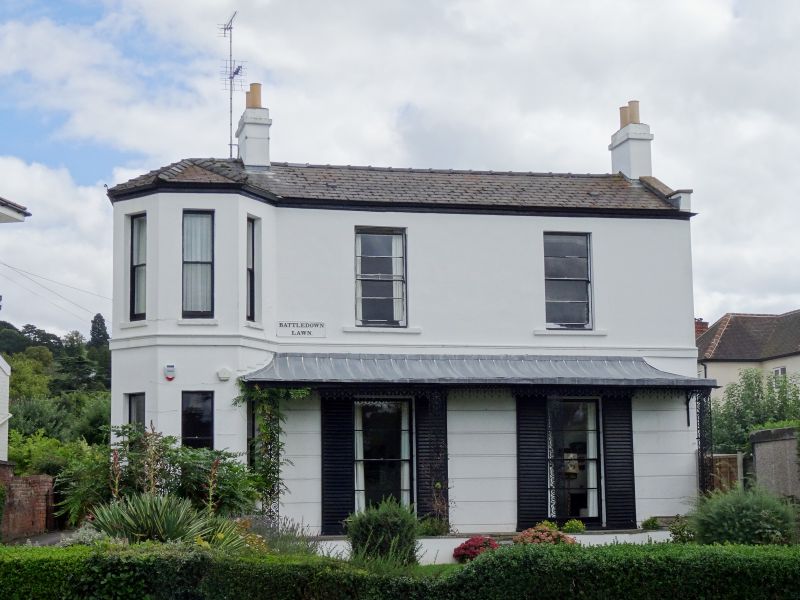
SO92SE HALE'S ROAD 630-1/2/364 (East side) No.123 Battledown Lawn
GV II
Villa. c1830-50. Stucco over brick with hipped artificial slate roof and iron verandah. EXTERIOR: 2 storeys, 3+2 first-floor windows. At left a full-height canted bay. Ground floor has horizontal rustication. First-floor moulded band. First floor, to bay are 3 narrow 1/1 sashes, otherwise 6/6 sashes. Ground floor has similar windows to bay, then two tall 1/1 sashes with louvred shutters. All in plain reveals and with sills. Entrance to left return, a 6-panel door with fanlight with batwing and circle glazing bars. INTERIOR: not inspected. SUBSIDIARY FEATURES: ground floor has verandah to right with ornate scroll motif balustrade and uprights.
Listing NGR: SO9617622258
External links are from the relevant listing authority and, where applicable, Wikidata. Wikidata IDs may be related buildings as well as this specific building. If you want to add or update a link, you will need to do so by editing the Wikidata entry.


Other nearby listed buildings