Latitude: 51.0051 / 51°0'18"N
Longitude: -2.1984 / 2°11'54"W
OS Eastings: 386175
OS Northings: 122876
OS Grid: ST861228
Mapcode National: GBR 1XH.WJ7
Mapcode Global: FRA 668G.CCM
Plus Code: 9C3V2R42+2J
Entry Name: Boundary Wall Flanking Park Walk on North Side in Curtilage of the Following Porperties Nos 17 and 19 High Street, Nos 6 and 8 Church Lane, Priory House, Church Lane, and the Remains of Shaftesbury Ab
Listing Date: 15 October 1973
Grade: II
Source: Historic England
Source ID: 1108722
English Heritage Legacy ID: 102091
ID on this website: 101108722
Location: Shaftesbury, Dorset, SP7
County: Dorset
Civil Parish: Shaftesbury
Built-Up Area: Shaftesbury
Traditional County: Dorset
Lieutenancy Area (Ceremonial County): Dorset
Church of England Parish: Shaftesbury St Peter
Church of England Diocese: Salisbury
Tagged with: Wall
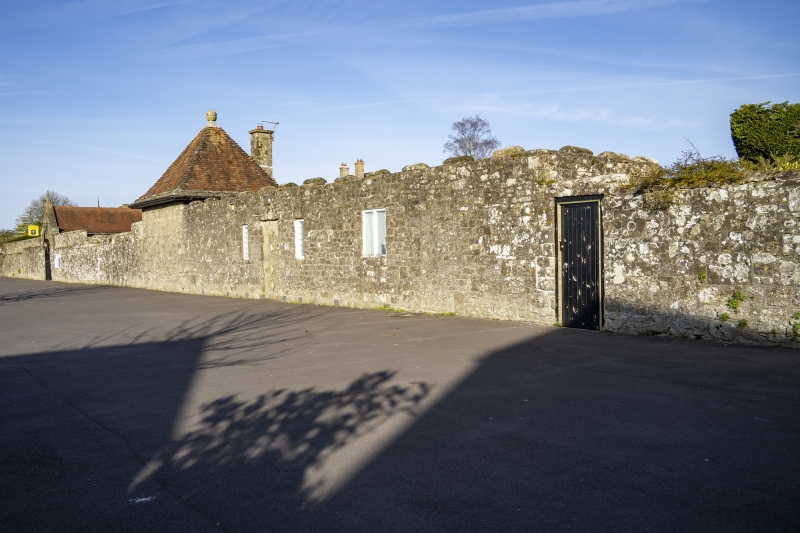
1. 1615 PARK WALK Boundary Wall flanking Park Walk on north side in curtilage of the following properties:- Nos 17 & 19 High Street, Nos 6 & 8 Church Lane, Priory House, Church Lane, and the remains of Shaftesbury Abbey. ST 8622 2/4A II 2. C18 possibly incorporating masonry from the medieval Abbey of Shaftesbury. Squared rubble masonry; stone coping. Approximately 8ft high. In eastern corner, and in north-east returning wall, which extends as far as King Alfred's Kitchen, Nos 6 and 8 Church Lane and Priory House in Church Lane [lower and without coping], and the Abbey of Shaftesbury. Wall also continues round grounds of The Abbey House [see Abbey Walk].
Listing NGR: ST8617122876
External links are from the relevant listing authority and, where applicable, Wikidata. Wikidata IDs may be related buildings as well as this specific building. If you want to add or update a link, you will need to do so by editing the Wikidata entry.


Other nearby listed buildings