Latitude: 51.0052 / 51°0'18"N
Longitude: -2.1986 / 2°11'54"W
OS Eastings: 386163
OS Northings: 122886
OS Grid: ST861228
Mapcode National: GBR 1XH.WGX
Mapcode Global: FRA 668G.C9C
Plus Code: 9C3V2R42+3H
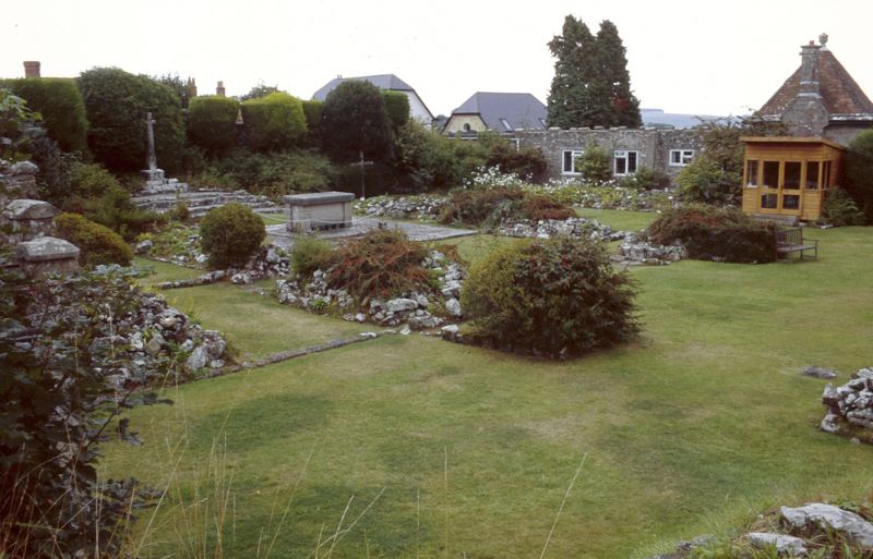
Entry Name: The Remains of Shaftesbury Abbey
Listing Date: 20 June 1952
Grade: I
Source: Historic England
Source ID: 1108779
English Heritage Legacy ID: 101941
ID on this website: 101108779
Location: Shaftesbury, Dorset, SP7
County: Dorset
Civil Parish: Shaftesbury
Built-Up Area: Shaftesbury
Traditional County: Dorset
Lieutenancy Area (Ceremonial County): Dorset
Church of England Parish: Shaftesbury St Peter
Church of England Diocese: Salisbury
1. 1655 The Remains of Shaftesbury Abbey ST 8622 2/4 20.6.52. I 2. Site adjacent to Park Wall, where the foundations of the greater part of the Abbey Church have been excavated. Many remains discovered, including bones thought to be those of King Edward the Martyr, to whom the Abbey was dedicated. The Abbey was a Benedictine Nunnery, founded by Alfred in 888, his daughter being the 1st Abbess. AM. See also Gold Hill.
Listing NGR: ST8613622887


Other nearby listed buildings