Latitude: 51.0047 / 51°0'16"N
Longitude: -2.1994 / 2°11'57"W
OS Eastings: 386108
OS Northings: 122831
OS Grid: ST861228
Mapcode National: GBR 1XH.W7C
Mapcode Global: FRA 668G.BZF
Plus Code: 9C3V2R32+V7
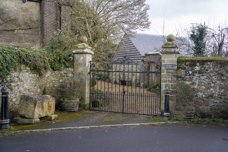
Entry Name: Boundary Wall Enclosing Grounds to Abbey House on South and West Sides with Gate Piers
Listing Date: 15 October 1973
Grade: II
Source: Historic England
Source ID: 1108781
English Heritage Legacy ID: 101944
ID on this website: 101108781
Location: St James, Dorset, SP7
County: Dorset
Civil Parish: Shaftesbury
Built-Up Area: Shaftesbury
Traditional County: Dorset
Lieutenancy Area (Ceremonial County): Dorset
Church of England Parish: Shaftesbury St Peter
Church of England Diocese: Salisbury
Tagged with: Wall
1. 1655 ABBEY WALK (North-East Side) Boundary Wall enclosing grounds to Abbey House on South and West sides with gate piers. ST 8622 2/7A II 2. C18 probably; later repairs. Stone rubble with stone coping, canted in towards north end at entrance to Abbey House. Ashlar gate piers with moulded caps and small ball finials. 2 similar ball finials on west wall to south of entrance, and another one over South West corner.
Listing NGR: ST8610822832
External links are from the relevant listing authority and, where applicable, Wikidata. Wikidata IDs may be related buildings as well as this specific building. If you want to add or update a link, you will need to do so by editing the Wikidata entry.


Other nearby listed buildings