Latitude: 51.4508 / 51°27'2"N
Longitude: -0.9701 / 0°58'12"W
OS Eastings: 471664
OS Northings: 172925
OS Grid: SU716729
Mapcode National: GBR QMH.6C
Mapcode Global: VHDWT.4SJP
Plus Code: 9C3XF22H+8X
Entry Name: St Giles Vicarage St Giles's Vicarage
Listing Date: 22 March 1957
Grade: II
Source: Historic England
Source ID: 1113451
English Heritage Legacy ID: 38876
ID on this website: 101113451
Location: Reading, Berkshire, RG1
County: Reading
Electoral Ward/Division: Katesgrove
Parish: Non Civil Parish
Built-Up Area: Reading
Traditional County: Berkshire
Lieutenancy Area (Ceremonial County): Berkshire
Church of England Parish: Reading St Giles
Church of England Diocese: Oxford
Tagged with: Clergy house
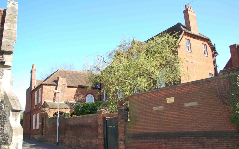
CHURCH STREET 1. 5128 (South Side) St Giles's Vicarage SU 7172 NE 4/86 22.3.57. II GV 2. 1743. 2 storeys red brick headers on plinth. Moulded brick cornice, parapet, hipped tiled roof. 4 glazing bar sash windows, segmental headed, on 1st floor to east and 2 later C19 7-light angled bay windows on ground floor. Sun Fire Insurance Mark No 17?525. To south is a stepped chimney and a double ridge roof. 2 window extension to west with band course, also glazing bar sashes, thick glazing bars on ground floor, entrance to right of this in 1872 loggia linking to 5 window 2 1/2 storey hall-wing. Interior: panelled hall with egg and dart moulding to cornice. Oak stair with turned balusters:
Listing NGR: SU7166472925
External links are from the relevant listing authority and, where applicable, Wikidata. Wikidata IDs may be related buildings as well as this specific building. If you want to add or update a link, you will need to do so by editing the Wikidata entry.


Other nearby listed buildings