Latitude: 51.4509 / 51°27'3"N
Longitude: -0.9699 / 0°58'11"W
OS Eastings: 471679
OS Northings: 172943
OS Grid: SU716729
Mapcode National: GBR QMH.79
Mapcode Global: VHDWT.4SML
Plus Code: 9C3XF22J+93
Entry Name: Wall Enclosing St Giles's Vicarage Garden
Listing Date: 14 December 1978
Grade: II
Source: Historic England
Source ID: 1303529
English Heritage Legacy ID: 38877
ID on this website: 101303529
Location: Reading, Berkshire, RG1
County: Reading
Electoral Ward/Division: Katesgrove
Parish: Non Civil Parish
Built-Up Area: Reading
Traditional County: Berkshire
Lieutenancy Area (Ceremonial County): Berkshire
Church of England Parish: Reading St Giles
Church of England Diocese: Oxford
Tagged with: Wall
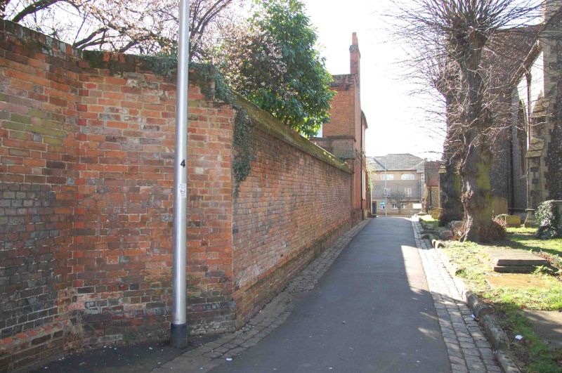
CHURCH STREET
1.
5128
(South Side)
Wall enclosing
St Gile's Vicarage
Garden
SU 7172 NE 4/452
II GV
2.
Probably early to mid C19. Brick with plinth and chamfered capping. About
9 feet high and 25 yards long to north side. Continued to east and returned
to south as far as Parish Hall on Southampton Street.
Listing NGR: SU7167972943
External links are from the relevant listing authority and, where applicable, Wikidata. Wikidata IDs may be related buildings as well as this specific building. If you want to add or update a link, you will need to do so by editing the Wikidata entry.


Other nearby listed buildings