Approximate Location Map
Large Map »
Latitude: 51.509 / 51°30'32"N
Longitude: -1.5317 / 1°31'54"W
OS Eastings: 432594
OS Northings: 179003
OS Grid: SU325790
Mapcode National: GBR 6Z0.9K8
Mapcode Global: VHC1D.DBLJ
Plus Code: 9C3WGF59+J8
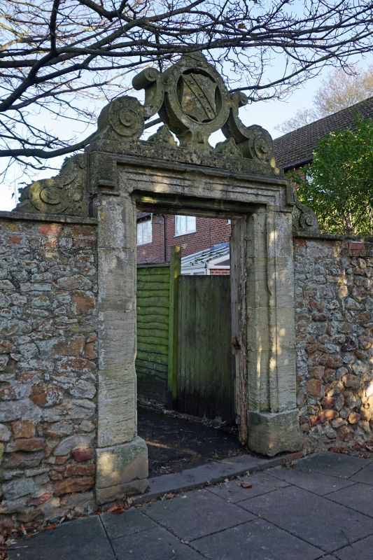
Entry Name: Gateway to Lambourn Place from churchyard
Listing Date: 11 July 1983
Grade: II
Source: Historic England
Source ID: 1113697
English Heritage Legacy ID: 39451
ID on this website: 101113697
Location: Lambourn, West Berkshire, RG17
County: West Berkshire
Civil Parish: Lambourn
Built-Up Area: Lambourn
Traditional County: Berkshire
Lieutenancy Area (Ceremonial County): Berkshire
Church of England Parish: Lambourn
Church of England Diocese: Oxford
Tagged with: Gate
SU 3278
4/13
LAMBOURN
MARKET PLACE (north side)
Gateway to Lambourn Place from churchyard
(Formerly listed as Gateway from Lambourn Place to Churchyard)
II
Gateway. C17, sarsen stone, Taynton stone and Bath stone, architrave surround supporting scrolls with date 16-63 and pierced cresting of scrolls and circle with arms.
Listing NGR: SU3259479003
External links are from the relevant listing authority and, where applicable, Wikidata. Wikidata IDs may be related buildings as well as this specific building. If you want to add or update a link, you will need to do so by editing the Wikidata entry.


Other nearby listed buildings
