Approximate Location Map
Large Map »
Latitude: 51.5086 / 51°30'30"N
Longitude: -1.532 / 1°31'55"W
OS Eastings: 432578
OS Northings: 178955
OS Grid: SU325789
Mapcode National: GBR 6Z0.9JB
Mapcode Global: VHC1D.DBGV
Plus Code: 9C3WGF59+C6
Entry Name: Table Tomb to Thomas Flory to South West of St Michael and All Angels Church
Listing Date: 11 July 1983
Grade: II
Source: Historic England
Source ID: 1321825
English Heritage Legacy ID: 39449
ID on this website: 101321825
Location: St Michael and All Angels Church, Lambourn, West Berkshire, RG17
County: West Berkshire
Civil Parish: Lambourn
Built-Up Area: Lambourn
Traditional County: Berkshire
Lieutenancy Area (Ceremonial County): Berkshire
Church of England Parish: Lambourn
Church of England Diocese: Oxford
Tagged with: Tomb
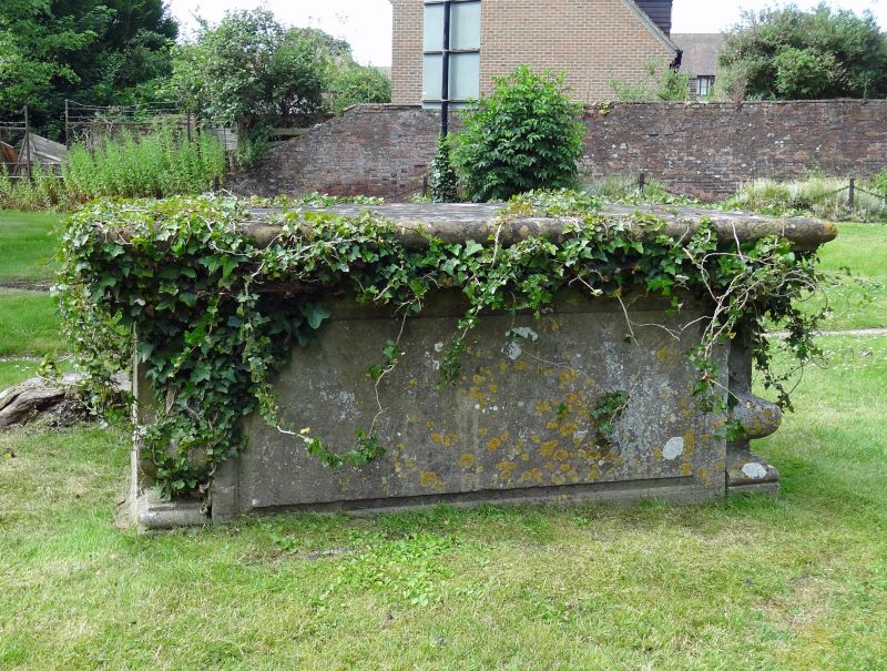
SU 3278 LAMBOURN MARKET PLACE
4/46 Table tomb to
Thomas Flory to
south-west of St Michael
and All Angels Church
II
Tomb. 1760. Stone. Low panelled table tomb with urn shaped corners. To
Thomas Flory.
Listing NGR: SU3257878955
External links are from the relevant listing authority and, where applicable, Wikidata. Wikidata IDs may be related buildings as well as this specific building. If you want to add or update a link, you will need to do so by editing the Wikidata entry.


Other nearby listed buildings
