Latitude: 52.0008 / 52°0'2"N
Longitude: -0.358 / 0°21'28"W
OS Eastings: 512818
OS Northings: 234868
OS Grid: TL128348
Mapcode National: GBR H56.DBN
Mapcode Global: VHFQW.RZ32
Plus Code: 9C4X2J2R+8R
Entry Name: Timbletoo
Listing Date: 29 July 1975
Grade: II
Source: Historic England
Source ID: 1113865
English Heritage Legacy ID: 37896
ID on this website: 101113865
Location: Upton End, Central Bedfordshire, SG5
County: Central Bedfordshire
Civil Parish: Shillington
Traditional County: Bedfordshire
Lieutenancy Area (Ceremonial County): Bedfordshire
Church of England Parish: Shillington and Gravenhurst
Church of England Diocese: St.Albans
Tagged with: Building
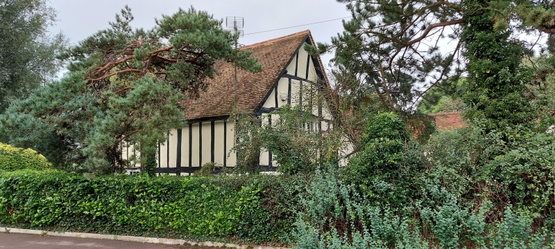
TL 1234 SHILLINGTON & UPTON END ROAD (West Side) STONDON 18/107 29.7.75 No. 39 (Timbletoo) II House. C17. Timber framed construction with colourwashed plaster infill. Clay tile roofs, and some C20 tiles. T-plan. 2 storeys. Variety of casements, mostly with glazing bars. S elevation: main block and RH gable each have one casement per floor. Lower block to LH has one ground floor casement. C20 lean-to porch at junction between main block and lower LH block, continuing roof slope of lower block. Red brick ridge stack with moulded cornice at LH end of main block. To N elevation single-storeyed addition projects from lower block and main block has slated lean-to within angle.
Listing NGR: TL1281834868
External links are from the relevant listing authority and, where applicable, Wikidata. Wikidata IDs may be related buildings as well as this specific building. If you want to add or update a link, you will need to do so by editing the Wikidata entry.


Other nearby listed buildings