Latitude: 52.0085 / 52°0'30"N
Longitude: -0.5269 / 0°31'36"W
OS Eastings: 501204
OS Northings: 235473
OS Grid: TL012354
Mapcode National: GBR G3M.5KS
Mapcode Global: VHFQS.TS95
Plus Code: 9C4X2F5F+96
Entry Name: Steppingly County Primary School
Listing Date: 1 March 1972
Grade: II
Source: Historic England
Source ID: 1113941
English Heritage Legacy ID: 38090
ID on this website: 101113941
Location: Steppingley, Central Bedfordshire, MK45
County: Central Bedfordshire
Civil Parish: Steppingley
Traditional County: Bedfordshire
Lieutenancy Area (Ceremonial County): Bedfordshire
Church of England Parish: Steppingley
Church of England Diocese: St.Albans
Tagged with: Building
STEPPINGLEY
TL 0035 CHURCH ROAD
4/105 Steppingley County Primary 1.3.72 School
GV II
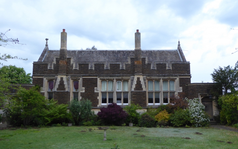
School. Circa 1870 by Henry Clutton, probably for the Duke of Bedford. Coursed ironstone with ashlar dressings. Slate roof. Large rectangular block with gabled roof, with single-storeyed entrance blocks to both gable ends. Loosely Tudor in style. Asymmetrical front elevation. 2 projecting chimney stacks, the lower parts combined with buttresses, the upper parts octagonal. LH stack is flanked by 2 single-light windows with transoms. RH stack is flanked by paired 2-light mullion and transom windows. All windows are square-headed, the lights with cambered arches. All have square labels with geometrical moulded stops. Embattled parapet. Stone coped gables with moulded finials. 2 entrance blocks have cambered headed doorways with plank doors on strap hinges. A moulded band at sill level of main block continues around entrance blocks, turning upwards around doorways to form labels.
Listing NGR: TL0120435473
External links are from the relevant listing authority and, where applicable, Wikidata. Wikidata IDs may be related buildings as well as this specific building. If you want to add or update a link, you will need to do so by editing the Wikidata entry.


Other nearby listed buildings