Latitude: 52.0063 / 52°0'22"N
Longitude: -0.5292 / 0°31'45"W
OS Eastings: 501054
OS Northings: 235228
OS Grid: TL010352
Mapcode National: GBR G3M.510
Mapcode Global: VHFQS.ST3V
Plus Code: 9C4X2F4C+G8
Entry Name: The Croft
Listing Date: 3 May 1985
Grade: II
Source: Historic England
Source ID: 1113943
English Heritage Legacy ID: 38093
ID on this website: 101113943
Location: Steppingley, Central Bedfordshire, MK45
County: Central Bedfordshire
Civil Parish: Steppingley
Traditional County: Bedfordshire
Lieutenancy Area (Ceremonial County): Bedfordshire
Church of England Parish: Steppingley
Church of England Diocese: St.Albans
Tagged with: Building Thatched cottage
STEPPINGLEY
TL 0035 PEAKES END
4/108 The Croft
- II
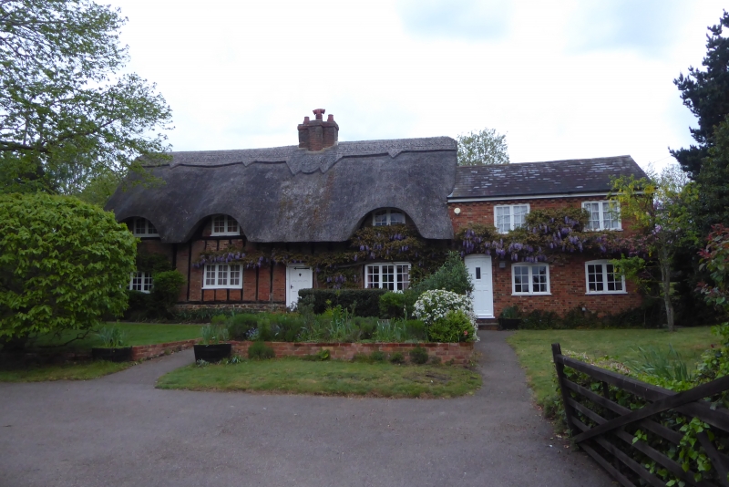
House. C17 with C19 addition. Timber framed structure with red brick infill on coursed ironstone rubble plinth. Thatched roof. 3-room plan, one storey and attics. Ground Floor has 3 3-light casements with glazing bars. Attic has 3 eyebrow dormers with segmental headed 2-light casements with glazing bars. C20 panelled door in moulded architrave. In line with this is red brick multiple ridge stack. C19 addition to RH end is 2-storeyed, of red brick and slate, with plank door and casement windows.
Listing NGR: TL0105435228
External links are from the relevant listing authority and, where applicable, Wikidata. Wikidata IDs may be related buildings as well as this specific building. If you want to add or update a link, you will need to do so by editing the Wikidata entry.


Other nearby listed buildings