Latitude: 51.8777 / 51°52'39"N
Longitude: -0.5935 / 0°35'36"W
OS Eastings: 496919
OS Northings: 220839
OS Grid: SP969208
Mapcode National: GBR F3S.6SC
Mapcode Global: VHFRJ.N2MC
Plus Code: 9C3XVCH4+3J
Entry Name: 2, High Street
Listing Date: 26 September 1980
Grade: II
Source: Historic England
Source ID: 1114670
English Heritage Legacy ID: 35925
ID on this website: 101114670
Location: Eaton Bray, Central Bedfordshire, LU6
County: Central Bedfordshire
Civil Parish: Eaton Bray
Built-Up Area: Eaton Bray
Traditional County: Bedfordshire
Lieutenancy Area (Ceremonial County): Bedfordshire
Church of England Parish: Eaton Bray with Edlesborough
Church of England Diocese: St.Albans
Tagged with: Building
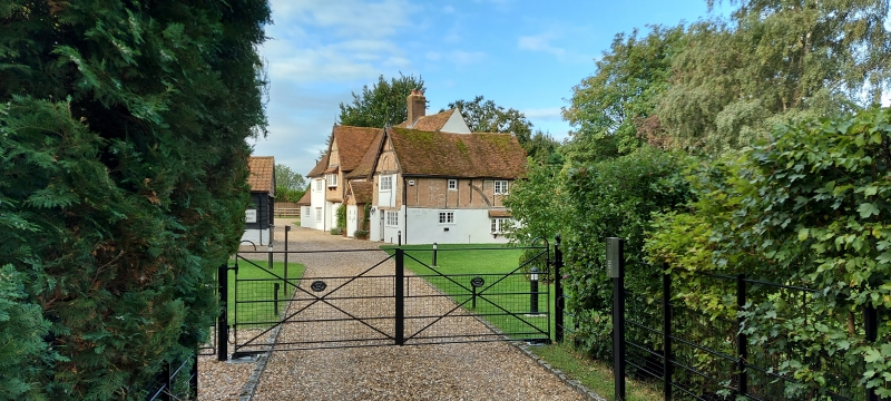
1.
5125
SP 9620
34/79
EATON BRAY
HIGH STREET
No 2
II
2.
Late C16 or early C17. Timber-framed with whitewashed brick nogging. Two storeys.
Old clay tile roof. Originally T-plan. West wing jettied. East wing added later.
Modern leaded casements, and modern central porch.
Listing NGR: SP9691920839
External links are from the relevant listing authority and, where applicable, Wikidata. Wikidata IDs may be related buildings as well as this specific building. If you want to add or update a link, you will need to do so by editing the Wikidata entry.


Other nearby listed buildings