Approximate Location Map
Large Map »
Latitude: 51.8756 / 51°52'32"N
Longitude: -0.589 / 0°35'20"W
OS Eastings: 497233
OS Northings: 220615
OS Grid: SP972206
Mapcode National: GBR F3S.7YH
Mapcode Global: VHFRJ.R30Z
Plus Code: 9C3XVCG6+7C
Entry Name: 70, High Street
Listing Date: 26 September 1980
Grade: II
Source: Historic England
Source ID: 1158390
English Heritage Legacy ID: 35926
ID on this website: 101158390
Location: Eaton Bray, Central Bedfordshire, LU6
County: Central Bedfordshire
Civil Parish: Eaton Bray
Built-Up Area: Eaton Bray
Traditional County: Bedfordshire
Lieutenancy Area (Ceremonial County): Bedfordshire
Church of England Parish: Eaton Bray with Edlesborough
Church of England Diocese: St.Albans
Tagged with: Building
1.
5125
SP 9720
35/80
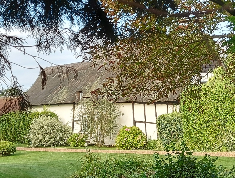
EATON BRAY
HIGH STREET
No 70
II
GV
2.
C17. Timber frame with colour-washed plaster. One storey and attic. Central
stack. Corrugated iron roof, modern windows.
Listing NGR: SP9723320615
External links are from the relevant listing authority and, where applicable, Wikidata. Wikidata IDs may be related buildings as well as this specific building. If you want to add or update a link, you will need to do so by editing the Wikidata entry.


Other nearby listed buildings
