Latitude: 51.8824 / 51°52'56"N
Longitude: -0.5982 / 0°35'53"W
OS Eastings: 496586
OS Northings: 221359
OS Grid: SP965213
Mapcode National: GBR F3K.ZJF
Mapcode Global: VHFRB.LY49
Plus Code: 9C3XVCJ2+XP
Entry Name: 27, the Rye
Listing Date: 26 September 1980
Grade: II
Source: Historic England
Source ID: 1114674
English Heritage Legacy ID: 35937
ID on this website: 101114674
Location: Honeywick, Central Bedfordshire, LU6
County: Central Bedfordshire
Civil Parish: Eaton Bray
Built-Up Area: Eaton Bray
Traditional County: Bedfordshire
Lieutenancy Area (Ceremonial County): Bedfordshire
Church of England Parish: Eaton Bray with Edlesborough
Church of England Diocese: St.Albans
Tagged with: Building
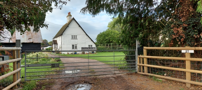
1.
5125 EATON BRAY THE RYE
No 27
SP 9621 30/94
II
2.
C17 timber frame with brick infill. Two storeys, modern roof, porch and windows.
Central stack. Small extension right hand.
Listing NGR: SP9658621359
External links are from the relevant listing authority and, where applicable, Wikidata. Wikidata IDs may be related buildings as well as this specific building. If you want to add or update a link, you will need to do so by editing the Wikidata entry.


Other nearby listed buildings