Approximate Location Map
Large Map »
Latitude: 51.9175 / 51°55'2"N
Longitude: -0.6095 / 0°36'34"W
OS Eastings: 495732
OS Northings: 225241
OS Grid: SP957252
Mapcode National: GBR F35.NQV
Mapcode Global: VHFRB.D24D
Plus Code: 9C3XW98R+X6
Entry Name: School House
Listing Date: 26 September 1980
Grade: II
Source: Historic England
Source ID: 1114680
English Heritage Legacy ID: 35949
ID on this website: 101114680
Location: Eggington, Central Bedfordshire, LU7
County: Central Bedfordshire
Civil Parish: Eggington
Traditional County: Bedfordshire
Lieutenancy Area (Ceremonial County): Bedfordshire
Church of England Parish: Eggington
Church of England Diocese: St.Albans
Tagged with: House
1.
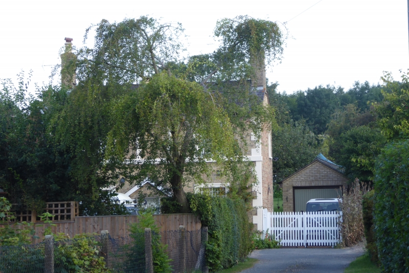
5125 EGGINGTON HIGH STREET
(north side)
School House
SP 9525 16/117
II
2.
Late C19. Yellow brick with stucco quoins. Two storeys. Welsh slate roof. Two
casements with glazing bars; very small panes; architrave surrounds. First floor
band. Gabled porch.
Listing NGR: SP9573225241
External links are from the relevant listing authority and, where applicable, Wikidata. Wikidata IDs may be related buildings as well as this specific building. If you want to add or update a link, you will need to do so by editing the Wikidata entry.


Other nearby listed buildings
