Latitude: 51.9172 / 51°55'1"N
Longitude: -0.6091 / 0°36'32"W
OS Eastings: 495762
OS Northings: 225206
OS Grid: SP957252
Mapcode National: GBR F35.NV8
Mapcode Global: VHFRB.D2CM
Plus Code: 9C3XW98R+V9
Entry Name: Eggington School
Listing Date: 26 September 1980
Grade: II
Source: Historic England
Source ID: 1321359
English Heritage Legacy ID: 35948
ID on this website: 101321359
Location: Eggington, Central Bedfordshire, LU7
County: Central Bedfordshire
Civil Parish: Eggington
Traditional County: Bedfordshire
Lieutenancy Area (Ceremonial County): Bedfordshire
Church of England Parish: Eggington
Church of England Diocese: St.Albans
Tagged with: School building
1.
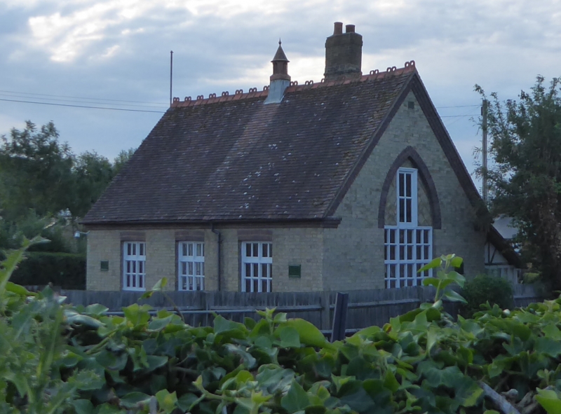
5125 EGGINGTON HIGH STREET
(north side)
Eggington School
SP 9525 16/116
II
2.
Late C19. Yellow brick with purple brick dressings, One storey. Clay tile roof
with crested ridge tiles. Projecting gable to right hand side. Pointed arch above
door and gable window in purple brick. Heavy central stack.
Listing NGR: SP9576225206
External links are from the relevant listing authority and, where applicable, Wikidata. Wikidata IDs may be related buildings as well as this specific building. If you want to add or update a link, you will need to do so by editing the Wikidata entry.


Other nearby listed buildings