Latitude: 50.1272 / 50°7'38"N
Longitude: -5.7087 / 5°42'31"W
OS Eastings: 135031
OS Northings: 31829
OS Grid: SW350318
Mapcode National: GBR DX8B.ZWG
Mapcode Global: VH05F.02D8
Plus Code: 9C2P47GR+VG
Entry Name: Mining Chimney
Listing Date: 24 March 1982
Grade: II
Source: Historic England
Source ID: 1115112
English Heritage Legacy ID: 351300
ID on this website: 101115112
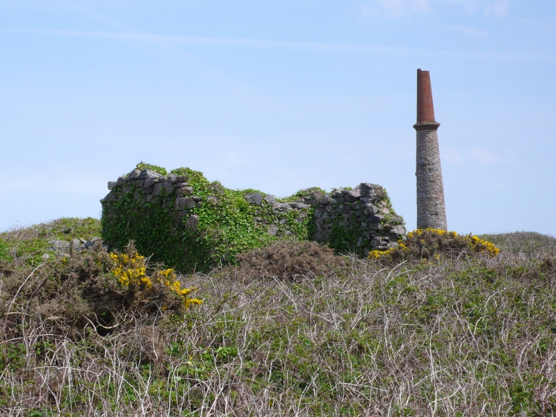
CAPE CORNWALL
-------------
Mining Chimney
1.
1589
SW 33 SE 1/158
II
2
C19. Coursed rubble base, red brick shaft, of which lower third octagonal
with, dummy tail round arches, corbelled cornice. Upper two-thirds cylindrical,
battered. A prominent landmark
.
Listing NGR: SW3503131829
External links are from the relevant listing authority and, where applicable, Wikidata. Wikidata IDs may be related buildings as well as this specific building. If you want to add or update a link, you will need to do so by editing the Wikidata entry.


Other nearby listed buildings