Approximate Location Map
Large Map »
Latitude: 51.547 / 51°32'49"N
Longitude: -2.4481 / 2°26'53"W
OS Eastings: 369022
OS Northings: 183214
OS Grid: ST690832
Mapcode National: GBR JX.FQXG
Mapcode Global: VH88B.JC4Y
Plus Code: 9C3VGHW2+QQ
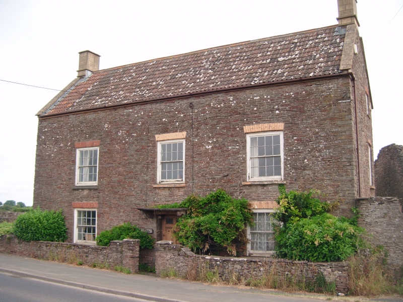
Entry Name: Wistaria Lodge
Listing Date: 27 November 1984
Grade: II
Source: Historic England
Source ID: 1116019
English Heritage Legacy ID: 350726
ID on this website: 101116019
Location: Nibley, South Gloucestershire, BS37
County: South Gloucestershire
Civil Parish: Iron Acton
Built-Up Area: Rangeworthy
Traditional County: Gloucestershire
Lieutenancy Area (Ceremonial County): Gloucestershire
Church of England Parish: Iron Acton
Church of England Diocese: Bristol
Tagged with: Gatehouse
ST 68 SE,
2/36
IRON ACTON,
YATE ROAD
Wistaria Lodge
II
House. Circa 1830. Rubble, stone and brick dressings, double roman tile roof
with raised coped verges. Two storeys, 3-bay facade, all windows 16-pane sashes under brick
lintels, central 6-panel door (top two glazed) under flat hood on decorated
brackets.
Listing NGR: ST6902283214
External links are from the relevant listing authority and, where applicable, Wikidata. Wikidata IDs may be related buildings as well as this specific building. If you want to add or update a link, you will need to do so by editing the Wikidata entry.


Other nearby listed buildings
