Approximate Location Map
Large Map »
Latitude: 50.8002 / 50°48'0"N
Longitude: -3.1876 / 3°11'15"W
OS Eastings: 316403
OS Northings: 100745
OS Grid: ST164007
Mapcode National: GBR LX.YXZF
Mapcode Global: FRA 466Z.9ZP
Plus Code: 9C2RRR26+3X
Entry Name: 79-83, High Street
Listing Date: 21 March 1972
Grade: II
Source: Historic England
Source ID: 1116945
English Heritage Legacy ID: 442566
ID on this website: 101116945
Location: Honiton, East Devon, EX14
County: Devon
District: East Devon
Civil Parish: Honiton
Built-Up Area: Honiton
Traditional County: Devon
Lieutenancy Area (Ceremonial County): Devon
Church of England Parish: Honiton with Monkton
Church of England Diocese: Exeter
Tagged with: Building
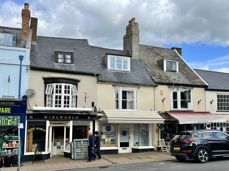
1. HIGH SiFEET
1228 (North Side)
Nos 79 to 83 (odd)
ST 1600 1/33
II GV
2.
C18 stucco houses, 2 storey and attic, casement dormers. Each house has
1st floor bay, that to No 83 being segmental. C19 shop fronts with cast
iron foliated supports.
Nos 73 to 101 (odd) and Allhallows Church form a group.
Listing NGR: ST1640000744
External links are from the relevant listing authority and, where applicable, Wikidata. Wikidata IDs may be related buildings as well as this specific building. If you want to add or update a link, you will need to do so by editing the Wikidata entry.


Other nearby listed buildings
