Latitude: 50.8002 / 50°48'0"N
Longitude: -3.1879 / 3°11'16"W
OS Eastings: 316384
OS Northings: 100738
OS Grid: ST163007
Mapcode National: GBR LX.YXWW
Mapcode Global: FRA 466Z.HVB
Plus Code: 9C2RRR26+3V
Entry Name: 89, High Street
Listing Date: 21 March 1972
Grade: II
Source: Historic England
Source ID: 1116947
English Heritage Legacy ID: 442568
ID on this website: 101116947
Location: Honiton, East Devon, EX14
County: Devon
District: East Devon
Civil Parish: Honiton
Built-Up Area: Honiton
Traditional County: Devon
Lieutenancy Area (Ceremonial County): Devon
Church of England Parish: Honiton with Monkton
Church of England Diocese: Exeter
Tagged with: Building
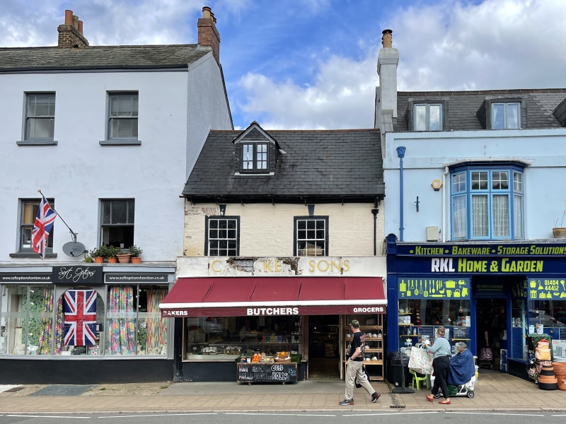
1. HIGH STREET
1228 (North Side)
No 89
ST 1600 1/34
II GV
2.
Early C18 altered, cream-washed brick front, 2 storey and sttic, gabled
casement dormer. Sash windows with flat arches with keystones. Shop front.
Nos 73 to 101 (odd) and Allhallows Chapel form a group.
Listing NGR: ST1638400738
External links are from the relevant listing authority and, where applicable, Wikidata. Wikidata IDs may be related buildings as well as this specific building. If you want to add or update a link, you will need to do so by editing the Wikidata entry.


Other nearby listed buildings